Category:18th-century maps of Lorient
Media in category "18th-century maps of Lorient"
The following 9 files are in this category, out of 9 total.
-
 094 Plan de Lorient vers 1760.jpg 1,480 × 1,915; 1.62 MB
-

-
 Anciennes et nouvelles sondes à Portlouis - Lebloch ; Lesage - btv1b53153586z (1 of 2).jpg 9,666 × 6,474; 6.22 MB
-
 Jacques-Nicolas Bellin - Carte de l'Enclos de Lorient.jpg 873 × 1,162; 325 KB
-
 Les environs de l'Orient et du Port-Louis par Georges-Louis Le Rouge.jpeg 2,669 × 1,425; 1.14 MB
-
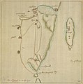 Lorient, 1746 1746 or later.jpg 1,978 × 2,000; 994 KB
-
 M0212 AG-2017-0-6182-U Longitude du meridien de l'Isle de Fer.jpg 2,500 × 1,782; 2.3 MB
-
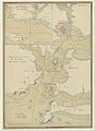 Plans des ports de France (1777) - Baie du Port-Louis.jpg 4,748 × 6,555; 4.2 MB
-
 Ville de Lorient - Bellin - btv1b8591952x.jpg 3,476 × 4,438; 2.79 MB


.jpg)


_-_Baie_du_Port-Louis.jpg)
