Category:18th-century maps of New Guinea
Media in category "18th-century maps of New Guinea"
The following 10 files are in this category, out of 10 total.
-
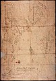
 AMH-5318-NA Map of the northern part of Nova Guinea.jpg 2,400 × 1,700; 707 KB
-
 AMH-5543-NA Map of the west and north coast of Nova Guinea.jpg 2,400 × 1,472; 618 KB
-
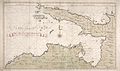
 AMH-5317-NA Map of Halmahera, Seram and Nove Guinea.jpg 2,400 × 1,703; 732 KB
-
 AMH-6667-KB Map of the Moluccas.jpg 2,400 × 1,914; 1,004 KB
-

-
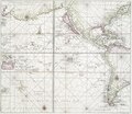
 AMH-5542-NA Chart showing the Halmaheira to Nova Guinea.jpg 1,672 × 2,400; 732 KB
-
 AMH-6426-NA Map showing the coasts of New Guinea.jpg 2,400 × 1,416; 597 KB
-
 Pacific Ocean showing part of North and South America.) NYPL478199.tiff 4,108 × 3,563; 41.88 MB
-
 Navigantium atque itinerantium bibliotheca Fleuron N010532-21.png 3,221 × 797; 86 KB
-
 AMH-8028-KB Floor plan of Fort Rotterdam at Makassar.jpg 1,733 × 2,400; 595 KB


