Category:18th-century maps of Quito
Media in category "18th-century maps of Quito"
The following 11 files are in this category, out of 11 total.
-
 Plano de la Ciudad de Quito en 1734, por Dionisio de Alcedo y Herrera.JPG 2,410 × 1,838; 1.51 MB
-
 1734 Plan of the City of Quito.jpg 2,014 × 1,694; 3.12 MB
-
 1736 French Draft of the Plan of Quito.jpg 1,799 × 1,260; 1.42 MB
-
 1784 Plan of the City of San Francisco of Quito.jpg 1,800 × 1,150; 1.88 MB
-
 Mapa de Quito 1751.png 1,143 × 606; 1.45 MB
-
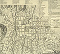 Mapaquito1786.jpg 1,900 × 1,693; 3.15 MB
-

-
 Plano de San Francisco del Quito (1735) - AHG.jpg 4,037 × 2,416; 13.83 MB
-
 Plano del Quito colonial Parte 1 año 1735 - AHG.jpg 8,378 × 9,094; 25.81 MB
-
 Plano del Quito colonial Parte 2 año 1735 - AHG.jpg 8,198 × 9,139; 22.82 MB
-
 Plano neuralgico de San Francisco del Quito 1735 - AHG.jpg 11,886 × 8,378; 33.82 MB


_-_AHG.jpg)


