Category:18th-century maps of Rotterdam
Media in category "18th-century maps of Rotterdam"
The following 8 files are in this category, out of 8 total.
-

-
 1757 Rotterdam detail of map Seat of War in the Circle of Westphalia BPL 14521.png 1,011 × 747; 1.41 MB
-
 1781 Rotterdam detail of Chart of the North Sea by John Lodge BPL 14726.png 1,035 × 748; 1.22 MB
-
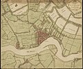 Kaart van Rotterdam en omgeving, 1784 (cropped).jpg 6,706 × 5,606; 12.41 MB
-
 Kaart van Rotterdam en omgeving, 1784.jpg 6,706 × 6,166; 14.52 MB
-
-
 Schiebroek, droogmaking polder (3382025704).jpg 1,570 × 2,000; 689 KB
-
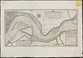
 Schieveense polder1712.JPG 572 × 488; 83 KB


.jpg)


.jpg)
