Category:18th-century maps of Vannes
Media in category "18th-century maps of Vannes"
The following 4 files are in this category, out of 4 total.
-
 L'Evesché de Vannes divisé en ses Doyennés et Territoires - btv1b5971844t.jpg 7,215 × 5,629; 4.25 MB
-
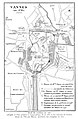
 Plan centre ville Vannes 1785.png 664 × 460; 529 KB
-
 Plan de Vannes en 1785 - détail du centre-vill.jpg 1,262 × 900; 257 KB
-
 Plan de Vannes en 1785.jpg 795 × 1,224; 222 KB


