Category:18th-century maps of Yucatán
Media in category "18th-century maps of Yucatán"
The following 15 files are in this category, out of 15 total.
-

-

-
 1777 Map of Cuba and Yucatan.jpg 1,588 × 667; 247 KB
-
-

-

-

-

-

-
 Map of Yucatan by Juan José de León 1798.jpg 650 × 707; 120 KB
-
 Map showing coast of northern Yucatán Peninsula. LOC 90683734.tif 5,525 × 7,913; 125.08 MB
-
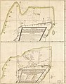
 Portos practicos de Canpeche (sic) LOC 90683743.jpg 6,988 × 4,877; 3.37 MB
-
 Portos practicos de Canpeche (sic) LOC 90683743.tif 6,988 × 4,877; 97.51 MB
-
 Presidio de Nuestra Señora del Carmen, 1767..jpg 2,981 × 1,728; 598 KB
-

_esta_por_latitud_de_22._grados_19._minutos_en_el_meridiano_de_la_Vigia_de_Yxil_en_la_costa_de_Yucat%C3%A1n._LOC_90683650.jpg)


_ygnogr%C3%A1fica_de_la_Provincia_de_Yucatan_desde_la_Laguna_de_Terminos_hasta_el_Cabo_Catoche_LOC_90683739.jpg)

_LOC_90683743.jpg)
