Category:18th-century maps of Yvelines
Media in category "18th-century maps of Yvelines"
The following 6 files are in this category, out of 6 total.
-
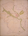
 Buchelay plan d'intendance 1776.png 3,814 × 2,819; 12.52 MB
-
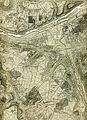
 Houdan - plan d'intendance.png 2,789 × 3,537; 9.19 MB
-
 Houdan plan d'intendance.JPG 2,908 × 3,672; 1.34 MB
-
 La Vallée de Chevreuse en 1701.jpg 4,912 × 3,200; 2.5 MB
-
 Plan de la ville, forts, ponts, étangs et territoire de Meullent.jpg 4,832 × 3,408; 1.19 MB
-
 Épône - Carte Topographique des Environs de Versailles f1 - 1764.jpg 2,550 × 3,509; 3.52 MB


