Category:1900s maps of Ethiopia
Countries of Africa: Algeria · Djibouti · Egypt‡ · Eritrea · Ethiopia · Libya · Madagascar · Morocco · Somalia · South Africa · Sudan · Tunisia · Zambia · Zimbabwe
Limited recognition: Somaliland
‡: partly located in Africa
Limited recognition: Somaliland
‡: partly located in Africa
Media in category "1900s maps of Ethiopia"
The following 16 files are in this category, out of 16 total.
-

-

-
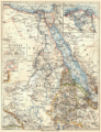 088 agypten-dar-fur-und-abessinien (1905).png 1,695 × 2,205; 2.24 MB
-
 D276- N° 466. L’Abyssinie indépendante. - Liv3-Ch20.png 1,442 × 1,912; 231 KB
-
 1908 Sayyid's Darwiish.png 5,938 × 3,521; 739 KB
-
 1908-1912 Sayyid's Darwiish.png 5,938 × 3,521; 742 KB
-
 Africa 1909, Edward Hertslet (Horn of Africa, detail).jpg 640 × 480; 72 KB
-

-

-

-
 Carte de la côte française des Somalis et régions avoisinantes, Harrar.jpg 1,392 × 1,054; 337 KB
-
-

-
 D247-Ethiopie, centre de culture.-L2-Ch7.png 1,440 × 1,533; 404 KB
-
 Sayyids Darwiish 1908.svg 1,425 × 845; 1,015 KB
-
 Православная богословская энциклопедия 01 0042.jpg 865 × 1,404; 1.18 MB
.jpg)
Marchand_Jean-Baptiste_btv1b53198373d_4.jpg)
.png)


.jpg)
.jpg)
.jpg)


.jpg)
_-_btv1b530635218.jpg)


