Category:1900s postcards of Bretagne
Administrative regions and territorial collectivity of Metropolitan France (‡ since start of 2016):
Brittany
Brittany
Subcategories
This category has the following 3 subcategories, out of 3 total.
Media in category "1900s postcards of Bretagne"
The following 200 files are in this category, out of 2,360 total.
(previous page) (next page)-
 026 Etel.jpg 1,845 × 1,076; 970 KB
-
 045 Cueillette des fraises à Plougastel vers 1900.JPG 2,876 × 1,696; 1.98 MB
-
 078 Sibiril.jpg 2,562 × 1,717; 2.24 MB
-
 079 Sibiril.jpg 2,487 × 1,491; 1.11 MB
-
 098 Chapelle de Kergornet.jpg 2,598 × 1,911; 2.19 MB
-
 099 Ménez-Hom.jpg 2,005 × 3,118; 4.62 MB
-
 100Fi557 Parc du Thabor Rennes.jpg 1,614 × 1,044; 244 KB
-
 113 Le sorcier de la montagne Laouic Coz.jpg 1,840 × 3,030; 4.19 MB
-
 127 Port Audierne.jpg 2,543 × 1,520; 2.21 MB
-
 128 Ville Audierne.jpg 2,411 × 1,499; 1.81 MB
-
 130 Train Audierne.jpg 2,342 × 1,549; 2.41 MB
-
 150 Le pardon des chevaux au Drennec.jpg 4,028 × 2,592; 7.46 MB
-
 162 Riec église Saint-Pierre.jpg 2,659 × 2,137; 2.61 MB
-
 165 Gare Audierne.jpg 2,575 × 1,837; 2.98 MB
-
 166 Gardeuse de vaches.jpg 3,134 × 2,322; 3.52 MB
-
 1900 Torce.tif 1,631 × 1,036; 2.59 MB
-
 1903 Tesnieres (2).jpg 2,971 × 1,865; 1.65 MB
-
 1903 Tesnieres.jpg 3,217 × 2,044; 2.26 MB
-
 1904 Théatre municipal de Quimper.jpg 972 × 622; 486 KB
-
 206 Pont-Aven Hôtel Julia.JPG 2,471 × 1,376; 1.75 MB
-
 291 Landivisiau.jpg 1,911 × 2,795; 1.91 MB
-
 295 Les laveuses sur l'Aven.jpg 3,225 × 2,191; 3.39 MB
-
 303 Maison Marie Henry.jpg 2,618 × 1,957; 2.44 MB
-
 3Fi007-134 - GUIPAVAS (FINISTERE) - CHAMP DE FOIRE PLACE SAINT-HERBOT.jpg 1,723 × 1,113; 207 KB
-
 3Fi007-135 - GUIPAVAS (FINISTERE) - EGLISE SAINT-PIERRE ET CROIX DE MISSION.jpg 1,723 × 1,113; 169 KB
-

-
 3Fi007-137 - GOUESNOU (FINISTERE) - MANOIR DU BOIS.jpg 1,727 × 1,127; 250 KB
-
 441 Aber Ildut.jpg 3,645 × 2,347; 2.19 MB
-
 472 Île Tristan.JPG 2,537 × 1,668; 2.87 MB
-
 600mm gauge Tramway de la Trinité à Étel, circa 1908 (45253767141).jpg 2,968 × 1,706; 686 KB
-
 679 Douarnenez.JPG 2,191 × 1,260; 1.04 MB
-
 683 Douarnenez.JPG 1,992 × 1,480; 1.7 MB
-
 687 Douarnenez.JPG 2,287 × 1,415; 1.64 MB
-
 689 Douarnenez.JPG 1,519 × 1,887; 1.07 MB
-
 691 Douarnenez.JPG 2,647 × 1,737; 1.65 MB
-
 694 Douarnenez.JPG 2,012 × 1,625; 1.72 MB
-
 88 C, Viaduc de Souzain en construction.jpg 813 × 489; 638 KB
-
 896 Le Pouldu Le bac traversant la Laïta.jpg 3,210 × 2,035; 3 MB
-
 995 Douarnenez.JPG 2,157 × 1,929; 1.34 MB
-
 996 Douarnenez.JPG 2,080 × 1,308; 1.37 MB
-
 Abbé Fouré Tombeau de saint Budoc.jpg 1,159 × 714; 689 KB
-
 AG 54 - RENNES - La gare de Viarmes (détail).JPG 2,217 × 1,313; 756 KB
-
 Allineuc - Vallée de l'Oust - AD22 - 16FI105.jpg 1,703 × 1,105; 260 KB
-

-
 Allée couverte Lesconil.jpg 1,568 × 1,036; 1.21 MB
-
 Ancienne église Riantec.jpg 800 × 499; 251 KB
-
 Ancienne église Saint-Etienne de Val d'Izé vers 1900.jpg 849 × 1,280; 272 KB
-
 Arzano maison Moustoir.jpg 1,428 × 868; 241 KB
-
 Arzano église.jpg 1,415 × 875; 238 KB
-
 Assemblée Bois-Bily 1905.jpg 600 × 380; 87 KB
-
 Atlier de brodeurs et de brodeuses Maison Pichavant.JPG 1,037 × 607; 367 KB
-
 Audierne Le quai de la gare vers 1900.jpg 792 × 478; 276 KB
-
 Audierne Phare et môle 1900.jpg 981 × 481; 352 KB
-
 Audierne Pêcheurs sur le port vers 1900.jpg 758 × 384; 203 KB
-
 Audierne Route du Cap 1900.jpg 602 × 379; 209 KB
-
 Audierne vers 1904.jpg 1,279 × 846; 839 KB
-
 Audierne Vue du port 1900.jpg 792 × 453; 317 KB
-
 Audierne.Hôtel du Commerce et quai.jpg 1,191 × 759; 222 KB
-
 Audierne.Le pont et la ville.jpg 1,189 × 744; 195 KB
-
 Audierne.Place du Marché.jpg 1,192 × 743; 211 KB
-
 Audierne.Pont du Goyen et quartier du Stum.jpg 1,192 × 757; 149 KB
-
 Audierne.Quai du Port.jpg 1,189 × 750; 175 KB
-
 Audierne.Église Saint-Raymond d'Audierne.jpg 1,190 × 754; 243 KB
-
 Auray (environs) - Cortège de trois noces réunies (1908).jpg 4,370 × 2,812; 4.4 MB
-
 Avant-garde laïque Fougères, 981-57-35.jpg 2,500 × 1,680; 2.95 MB
-
 Baden Kergonano.jpg 798 × 434; 170 KB
-
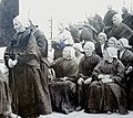
 Barde breton vers 1900 en Bretagne (51555061354).jpg 2,267 × 3,683; 4.2 MB
-
 Barde populaire vers 1900 en Bretagne (51553544522).jpg 2,322 × 3,633; 5.23 MB
-
 Bas Pont-Scorff 1908.jpg 1,593 × 1,018; 1.1 MB
-
 Bath in Paramé postcard.jpeg 2,671 × 1,845; 3.92 MB
-
 Belle-Isle-en-Terre - - Chapelle de Loc-Maria - Jubé XVI e siècle - AD22 - 16FI203.jpg 1,690 × 1,118; 345 KB
-
 Belle-Isle-en-Terre - - Danse bretonne - AD22 - 16FI194.jpg 1,714 × 1,115; 287 KB
-
 Belle-Isle-en-Terre - - Paysage sur le Guer - AD22 - 16FI198.jpg 1,709 × 1,117; 260 KB
-
 Belle-Isle-en-Terre - - Pont sur le Guer - AD22 - 16FI197.jpg 1,703 × 1,117; 351 KB
-
 Belle-Isle-en-Terre - - Rue Craëhugen - AD22 - 16FI207.jpg 1,711 × 1,126; 294 KB
-
 Belle-Isle-en-Terre - - Une villa - AD22 - 16FI193.jpg 1,124 × 1,723; 265 KB
-
 Belle-Isle-en-Terre - - Vallée du Guer - AD22 - 16FI204.jpg 1,713 × 1,129; 254 KB
-
 Belle-Isle-en-Terre - Avenue des Bicyclettes - AD22 - 16FI211.jpg 1,717 × 1,120; 333 KB
-
 Belle-Isle-en-Terre - Belle-Isle-en-Terre Les Halles - AD22 - 16FI186.jpg 1,691 × 1,111; 304 KB
-
 Belle-Isle-en-Terre - Bords du Guer route de Plounévez-Moëdec - AD22 - 16FI199.jpg 1,723 × 1,123; 253 KB
-
 Belle-Isle-en-Terre - Chapelle de Loc-Maria - AD22 - 16FI206.jpg 1,724 × 1,107; 394 KB
-
 Belle-Isle-en-Terre - Cimetière - AD22 - 16FI205.jpg 1,719 × 1,116; 359 KB
-
 Belle-Isle-en-Terre - Ferme à Loc-Maria - AD22 - 16FI195.jpg 1,708 × 1,105; 337 KB
-
 Belle-Isle-en-Terre - Mendiante - AD22 - 16FI213.jpg 1,121 × 1,734; 288 KB
-
 Belle-Isle-en-Terre - Minoterie sur le Guic - AD22 - 16FI189.jpg 1,716 × 1,111; 308 KB
-
 Belle-Isle-en-Terre - Moulin sur le Guer - AD22 - 16FI188.jpg 1,705 × 1,122; 299 KB
-
 Belle-Isle-en-Terre - Pont Malaben sur le Guer - AD22 - 16FI184.jpg 1,706 × 1,115; 267 KB
-
 Belle-Isle-en-Terre - Pont Pratelez - AD22 - 16FI210.jpg 1,726 × 1,124; 357 KB
-
 Belle-Isle-en-Terre - Rue du Pont Cunuder - AD22 - 16FI183.jpg 1,699 × 1,149; 256 KB
-
 Belle-Isle-en-Terre - Rue du Pont Malaben - AD22 - 16FI187.jpg 1,707 × 1,135; 240 KB
-
 Belle-Isle-en-Terre - Rue du Pont Malaben - AD22 - 16FI208.jpg 1,731 × 1,110; 302 KB
-
 Belle-Isle-en-Terre - Rue Eudon - AD22 - 16FI182.jpg 1,700 × 1,126; 292 KB
-
 Belle-Isle-en-Terre - Vallée du Guer - AD22 - 16FI200.jpg 1,713 × 1,110; 304 KB
-
 Belle-Isle-en-Terre - Vallée du Guer - AD22 - 16FI202.jpg 1,706 × 1,130; 323 KB
-
 Belle-Isle-en-Terre - Vieux Pont sur le Guer - AD22 - 16FI2135.jpg 1,715 × 1,143; 359 KB
-
-
 Belle-Isle-en-Terre - Vue générale - AD22 - 16FI181.jpg 1,702 × 1,119; 245 KB
-
 Belle-Isle-en-Terre - Vue générale - AD22 - 16FI185.jpg 1,721 × 1,109; 282 KB
-
 Belle-Isle-en-Terre - Vue prise du pont - AD22 - 16FI190.jpg 1,118 × 1,714; 217 KB
-
 Belle-Isle-en-Terre - Église - AD22 - 16FI191.jpg 1,108 × 1,706; 307 KB
-
 Berné chaussée de l'étang.jpg 1,438 × 898; 232 KB
-
 Berné pardon Sainte Anne des Bois.jpg 998 × 628; 195 KB
-
 Berné sabotiers Angélus.jpg 1,369 × 876; 323 KB
-
 Berné vieux chouan.jpg 610 × 901; 206 KB
-
 Bignan.Grande-Rue.jpg 692 × 453; 121 KB
-
 Binic - Binic vu de la vallée - AD22 - 16FI253.jpg 1,678 × 1,125; 341 KB
-
 Binic - Bénédiction des navires avant le départ - AD22 - 16FI220.jpg 1,695 × 1,119; 292 KB
-
 Binic - Chapelle de Saint-Gilles - AD22 - 16FI260.jpg 1,666 × 1,102; 350 KB
-
 Binic - Départ pour la pêche d'Islande - AD22 - 16FI223.jpg 1,696 × 1,117; 228 KB
-
 Binic - Jetée un jour de tempête - AD22 - 16FI269.jpg 1,711 × 1,105; 280 KB
-
 Binic - Plage de l'Avant-Port Marée haute - AD22 - 16FI244.jpg 1,682 × 1,123; 267 KB
-
 Binic - Plage de l'avant-port à mer haute - AD22 - 16FI274.jpg 1,713 × 1,109; 288 KB
-
 Binic - Pontceau sur l'Ic - AD22 - 16FI268.jpg 1,106 × 1,699; 380 KB
-
 Binic - Port - AD22 - 16FI227.jpg 1,709 × 1,126; 201 KB
-
 Binic - Quais - AD22 - 16FI278.jpg 1,703 × 1,099; 249 KB
-
 Binic - Quais à marée haute - AD22 - 16FI236.jpg 1,709 × 1,132; 199 KB
-
 Binic - Viaduc du Chien-Noir à Binic - AD22 - 16FI261.jpg 1,714 × 1,113; 339 KB
-
 Binic - Viaducs de la Hasée et du Beau-Feuillage - AD22 - 16FI263.jpg 1,687 × 1,103; 269 KB
-
 Binic - Vue de la Banche - AD22 - 16FI276.jpg 1,718 × 1,112; 237 KB
-
 Bodinio 04r.jpg 530 × 825; 74 KB
-
 Boqueho - Église et place - AD22 - 16FI299.jpg 1,701 × 1,115; 304 KB
-
 Bourbriac - Tour de Coatliou - AD22 - 16FI310.jpg 1,131 × 1,709; 469 KB
-
 Bourbriac - Église - AD22 - 16FI308.jpg 1,132 × 1,699; 259 KB
-
 Bourg Loyat début XXe.jpg 800 × 512; 151 KB
-
 Bourg Plouigneau 1900.jpg 997 × 644; 432 KB
-
 Bourg Sourn début XXe A. Waron.jpg 791 × 482; 205 KB
-
 Brandérion Route nationale.jpg 800 × 505; 430 KB
-
 Bretagne, cordier - les petits métiers populaires.jpg 956 × 600; 374 KB
-
 Briec 1906 querelle des inventaires.jpg 1,596 × 1,021; 1.15 MB
-
 Briec querelle des inventaires.jpg 1,600 × 1,034; 1.36 MB
-
 Bringolo - Église - AD22 - 16FI499.jpg 1,699 × 1,109; 344 KB
-
 Brittanydung.jpg 3,123 × 2,101; 5.19 MB
-
 Brière inondations 1903 Saint-Joachim.jpg 744 × 472; 232 KB
-
 Broons - Chapelle de la communauté - AD22 - 16FI515.jpg 1,134 × 1,708; 302 KB
-

-
 Broons - Place et communauté - AD22 - 16FI509.jpg 1,658 × 1,077; 290 KB
-
 Broons - Place et communauté - AD22 - 16FI510.jpg 1,695 × 1,115; 351 KB
-
 Broons - Vieille porte du château de la Ville-Morel - AD22 - 16FI502.jpg 1,687 × 1,108; 364 KB
-
 Broons - Vieux portails de la Ville Morelle - AD22 - 16FI516.jpg 1,713 × 1,123; 357 KB
-
 Bruz Manoir Saint-Armel.jpg 1,481 × 928; 434 KB
-
 Bruz Rue des mines de Pont-Péan.jpg 800 × 494; 179 KB
-
 Brélès Keroulas Bourdonnec.jpg 1,596 × 1,007; 1,020 KB
-
 Brélévenez - Église - AD22 - 16FI2181.jpg 1,118 × 1,729; 314 KB
-
 Brûlage du goémon au Loc'h.jpg 767 × 511; 58 KB
-
 Brûlage du goémon Porspoder 1902.jpg 695 × 450; 209 KB
-
 Btv1b101055351 Saint-Pol-de-Léon.jpg 1,050 × 1,656; 304 KB
-
 Btv1b101057490 Le Fort du Mengant.jpg 1,636 × 1,072; 247 KB
-
 Btv1b10105753q Porte du Manoir de Kérigant.jpg 1,644 × 1,052; 365 KB
-
 Btv1b10105755m Château du Grand-Chesnay.jpg 1,653 × 1,026; 256 KB
-
 Btv1b101058980 Le Faouët.jpg 1,623 × 1,048; 250 KB
-
 Btv1b10106070w Bonne vieille de Guémené.jpg 870 × 1,402; 147 KB
-
 Btv1b10106202n Manoir du Tromeur-en-Bohars.jpg 1,629 × 1,056; 364 KB
-
 Btv1b10106207w Ruines de Roquelaure.jpg 1,605 × 1,044; 282 KB
-
 Btv1b10106259v Le Pont Transbordeur.jpg 1,631 × 1,058; 299 KB
-
 Btv1b101065160 LE POULDU - Les Grands Sables.jpg 1,629 × 1,044; 285 KB
-
 Btv1b10106790c Le Château de Brest.jpg 1,650 × 1,056; 293 KB
-
 Bubry château brûlé.jpg 1,483 × 893; 566 KB
-
 Buvette de la Plage Le Pouldu.jpg 520 × 328; 48 KB
-
 Bégard - Le Bon Sauveur entrée principale - AD22 - 16FI112.jpg 1,708 × 1,102; 275 KB
-
 Callac - Entrée de la ville - AD22 - 16FI526.jpg 1,629 × 1,027; 511 KB
-
 Callac - Rue de l'église - AD22 - 16FI529.jpg 1,683 × 1,122; 316 KB
-
 Callac - Église - AD22 - 16FI528.jpg 1,626 × 1,013; 622 KB
-
 Calvaire Moréac.jpg 1,016 × 1,600; 1.37 MB
-
 CAMP DE COETQUIDAN ,CIRCA 1909, Manoeuvre du canon de 155mmmm. (51360613501).jpg 2,454 × 1,556; 989 KB
-
 Cancale - Hôtel Duguesclin 1903.jpg 668 × 440; 42 KB
-
 Cancale - port en 1903.jpg 401 × 315; 21 KB
-
 Cap Fréhel - Arrivée à Fort Lalatte - AD22 - 16FI1355.jpg 1,718 × 1,121; 307 KB
-
 Cap Fréhel - Doigt de Gargantua - AD22 - 16FI3905.jpg 1,110 × 1,718; 249 KB
-
 Cap Fréhel - Entrée des grottes - AD22 - 16FI3896.jpg 1,136 × 1,722; 304 KB
-
 Cap Fréhel - Entrée des grottes - AD22 - 16FI3975.jpg 1,124 × 1,723; 294 KB
-
 Cap Fréhel - Etude de rochers au Cap - AD22 - 16FI3894.jpg 1,114 × 1,709; 293 KB
-
 Cap Fréhel - Extrême pointe du cap - AD22 - 16FI3882.jpg 1,726 × 1,121; 323 KB
-
 Cap Fréhel - Extrême pointe du cap - AD22 - 16FI3884.jpg 1,703 × 1,124; 325 KB
-
 Cap Fréhel - Extrême pointe du Cap - AD22 - 16FI6883.jpg 1,710 × 1,111; 302 KB
-
 Cap Fréhel - Fauconnière - AD22 - 16FI3858.jpg 1,697 × 1,114; 272 KB
-
 Cap Fréhel - Fond de la grande grotte - AD22 - 16FI3973.jpg 1,114 × 1,718; 313 KB
-
 Cap Fréhel - Fort Lalatte - AD22 - 16FI1352.jpg 1,720 × 1,128; 293 KB
-
 Cap Fréhel - Fort Lalatte - AD22 - 16FI1354.jpg 1,726 × 1,122; 329 KB
-
 Cap Fréhel - Fort Lalatte - AD22 - 16FI3915.jpg 1,701 × 1,111; 278 KB
-
 Cap Fréhel - Fort Lalatte - AD22 - 16FI3940.jpg 1,721 × 1,114; 255 KB
-
 Cap Fréhel - Fort Lalatte - AD22 - 16FI3974.jpg 1,726 × 1,138; 196 KB
-
 Cap Fréhel - Fort Lalatte et colonne de Saint-Cast - AD22 - 16FI3898.jpg 1,709 × 1,123; 203 KB
-
 Cap Fréhel - Fort Lalatte et la Pierre de Gargantua - AD22 - 16FI3899.jpg 1,706 × 1,097; 245 KB
-
 Cap Fréhel - La Fauconnière - AD22 - 16FI3868.jpg 1,702 × 1,107; 368 KB
-
 Cap Fréhel - La Fauconnière - AD22 - 16FI3869.jpg 1,707 × 1,113; 335 KB
-
-
 Cap Fréhel - Menhir ou pierre de Gargantua - AD22 - 16FI3907.jpg 1,124 × 1,722; 347 KB
-
 Cap Fréhel - Restaurant du Cap - AD22 - 16FI3853.jpg 1,715 × 1,127; 313 KB
-
 Cap Fréhel - Rocher au Cap Fréhel - AD22 - 16FI3866.jpg 1,100 × 1,703; 331 KB
-
 Cap Fréhel - Rocher de la Fauconnière - AD22 - 16FI3948.jpg 1,124 × 1,693; 375 KB
-
 Cap Fréhel - Rochers - AD22 - 16FI3895.jpg 1,114 × 1,701; 314 KB
-
 Cap Fréhel - Rochers Massé et ancien cimetière romain - AD22 - 16FI3946.jpg 1,706 × 1,116; 300 KB
-
 Cap Fréhel - Village de la Roche près du Fort Lalatte - AD22 - 16FI3839.jpg 1,702 × 1,103; 264 KB
-
 Cap Fréhel - Vue d'ensemble du phare de Cap Fréhel - AD22 - 16FI1356.jpg 1,721 × 1,108; 273 KB
-
 CARHAIX Vieille cuisine (51542818728).jpg 1,805 × 2,809; 2.14 MB
-
 Carte de Charles Le Goffic à A.Renault (EMR).jpg 1,042 × 1,598; 619 KB
-
 Carte des prix Prat-ar-Coum.jpg 594 × 426; 166 KB
-
 Carte postale d'une proche d'un Islandais.jpg 2,500 × 1,663; 1.77 MB
-
 Carte postale en breton du 13 septembre 1901 - arrière (Cézembre).jpg 2,500 × 1,683; 2.09 MB
-
 Cavalcade de Retiers 1909.jpg 472 × 296; 139 KB


.jpg)


_-_CHAMP_DE_FOIRE_PLACE_SAINT-HERBOT.jpg)
_-_EGLISE_SAINT-PIERRE_ET_CROIX_DE_MISSION.jpg)
_-_LA_CHAPELLE_NOTRE-DAME_DE_REUN_ET_LE_HAUT_DU_BOURG.jpg)
_-_MANOIR_DU_BOIS.jpg)


.jpg)


.JPG)


_-_Cort%C3%A8ge_de_trois_noces_r%C3%A9unies_(1908).jpg)


.jpg)
.jpg)


.jpg)


.jpg)
.jpg)


.jpg)
