Category:1903 maps of New York (state)
States of the United States: California · Hawaii · Idaho · Illinois · Indiana · Iowa · Kentucky · Louisiana · Maryland · Massachusetts · Michigan · Minnesota · Missouri · Nebraska · New York · Oklahoma · Pennsylvania · South Dakota · Utah · Vermont · Washington · Wisconsin · Wyoming – Washington, D.C.
| ← 1900 1901 1902 1903 1904 1905 1906 1907 1908 1909 → |
Media in category "1903 maps of New York (state)"
The following 8 files are in this category, out of 8 total.
-
 Annual report (1903) (14751692802).jpg 2,373 × 3,010; 759 KB
-
 Annual report (1903) (17807082474).jpg 4,224 × 2,765; 1.31 MB
-
 Annual report (1903) (18240717348).jpg 3,210 × 1,530; 1.79 MB
-
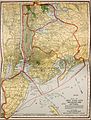 NIE 1905 New York (city) - New York City and Vicinity.jpg 1,666 × 2,202; 1.18 MB
-
 Street map of Fulton, N.Y. - with street numbers. LOC 2004629163.jpg 4,187 × 6,419; 4.26 MB
-
 Street map of Fulton, N.Y. - with street numbers. LOC 2004629163.tif 4,187 × 6,419; 76.89 MB
-

-
 Wildwood Lake Park, Riverhead, Township of Southhampton, Suffolk County, N.Y. LOC 00552207.tif 7,481 × 5,538; 118.53 MB
_(14751692802).jpg)
_(17807082474).jpg)
_(18240717348).jpg)
_-_New_York_City_and_Vicinity.jpg)

