Category:1909 maps of Europe
Temperate regions: North America · South America · Africa · Europe · Asia · – Polar regions: – Other regions:
English: 1909 maps of Europe
Español: Mapas de Europa en 1909
Suomi: Euroopan kartat vuodelta 1909
Română: Hărți ale Europei din 1909
Subcategories
This category has the following 9 subcategories, out of 9 total.
.
F
G
I
- 1909 maps of Italy (5 F)
N
R
- 1909 maps of Russia (3 F)
S
- 1909 maps of Spain (3 F)
- 1909 maps of Switzerland (3 F)
T
- 1909 maps of Turkey (empty)
Media in category "1909 maps of Europe"
The following 6 files are in this category, out of 6 total.
-
 Cvijic Boka 1909.gif 537 × 548; 171 KB
-
 ETH-BIB-Sahara Staubfall, 9.-12. III. 1901-Dia 247-Z-00144.tif 2,860 × 3,407; 28.02 MB
-
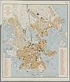 Helsingin asemakaava 1909.jpeg 5,288 × 6,184; 4.53 MB
-
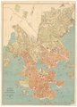 Helsingin kartta 1909.TIF 9,741 × 13,524; 376.9 MB
-

-
 Problème ? Le Rhin, les Alpes, le Danube, l'Euphrate, les mers, les détroits.jpg 8,951 × 7,046; 10.57 MB


