Category:1910 maps of Wisconsin
States of the United States: California · Idaho · Illinois · Indiana · Iowa · Louisiana · Massachusetts · Michigan · Minnesota · Missouri · New Jersey · New York · North Dakota · Ohio · Oklahoma · Pennsylvania · South Dakota · Texas · Utah · Vermont · Virginia · Wisconsin – Washington, D.C.
| ← 1910 1911 1912 1913 1914 1915 1916 1917 1918 1919 → |
Subcategories
This category has the following 7 subcategories, out of 7 total.
S
Media in category "1910 maps of Wisconsin"
The following 6 files are in this category, out of 6 total.
-
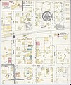
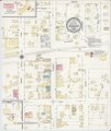
 Sanborn Fire Insurance Map from Oregon, Dane County, Wisconsin. LOC sanborn09651 003.jpg 6,450 × 7,650; 3.86 MB
-
 Sanborn Fire Insurance Map from Oregon, Dane County, Wisconsin. LOC sanborn09651 003.tif 6,450 × 7,650; 141.17 MB
-
-
 Sanborn Fire Insurance Map from Union Grove, Racine County, Wisconsin. LOC sanborn09721 003.tif 6,450 × 7,650; 141.17 MB
-

-
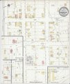 Sanborn Fire Insurance Map from Trempealeau, Trempealeau County, Wisconsin. LOC sanborn09717 003.tif 6,450 × 7,650; 141.17 MB


