Category:1910s maps of Mecklenburg-Vorpommern
|
Federal states of Germany: |
Media in category "1910s maps of Mecklenburg-Vorpommern"
The following 4 files are in this category, out of 4 total.
-

-
 GK25 NeueNr.2130 Luebeck 1915 FID-GEO (cropped).jpg 6,034 × 4,327; 8.98 MB
-
 GK25 NeueNr.2130 Luebeck 1915 FID-GEO.jpg 12,059 × 12,605; 58.46 MB
-
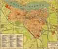 MAP - Rostock 1918.jpg 1,400 × 1,169; 307 KB
_-_btv1b8445468p_(1_of_2).jpg)
.jpg)

