Category:1911 maps
| ← · 1910 · 1911 · 1912 · 1913 · 1914 · 1915 · 1916 · 1917 · 1918 · 1919 · → |
Deutsch: Karten mit Bezug zum Jahr 1911
English: Maps related to the year 1911
Español: Mapas relativos al año 1911
Français : Cartes concernant l’an 1911
Русский: Карты 1911 года
Subcategories
This category has the following 9 subcategories, out of 9 total.
Media in category "1911 maps"
The following 146 files are in this category, out of 146 total.
-

-
 1911 Beirut map.jpg 475 × 509; 132 KB
-
 1911 Map of Kolkata West Bengal India.jpg 1,758 × 2,244; 525 KB
-
 1911 map of proposed tunnel to East Boston.png 5,000 × 792; 6.22 MB
-
 1911 Tri-state Trolley Map.png 2,583 × 3,500; 17.01 MB
-
 1911 Tripoli map NGS.png 845 × 693; 555 KB
-
 Alexandria (1).jpg 420 × 318; 216 KB
-
 Alexandria City showing connections with Washington LOC 89692657.jpg 6,132 × 9,309; 4.81 MB
-
 Alexandria City showing connections with Washington LOC 89692657.tif 6,132 × 9,309; 163.32 MB
-
 Amrail.png 1,950 × 820; 975 KB
-
 An Australian bird book - a pocket book for field use (1911) (19727029934).jpg 2,912 × 1,740; 1.21 MB
-
 Armenia map detail, from- Shepherd-c-020 (cropped).jpg 667 × 523; 167 KB
-
 Atlanta-1911.jpg 3,685 × 2,765; 4.06 MB
-
 Atlas-Mass-Holyoke 1911 006.jpg 7,733 × 5,437; 11.19 MB
-
 Atlas-Mass-Holyoke 1911 007.jpg 7,733 × 5,437; 13.87 MB
-
 Atlas-Mass-Holyoke 1911 008.jpg 7,733 × 5,437; 11.92 MB
-
 Atlas-Mass-Holyoke 1911 009.jpg 7,747 × 5,437; 13.71 MB
-
 Atlas-Mass-Holyoke 1911 010.jpg 7,747 × 5,423; 12.18 MB
-
 Atlas-Mass-Holyoke 1911 011.jpg 7,733 × 5,437; 12.21 MB
-
 Atlas-Mass-Holyoke 1911 012.jpg 7,747 × 5,437; 9.71 MB
-
 Atlas-Mass-Holyoke 1911 013.jpg 7,747 × 5,409; 10.83 MB
-
 Atlas-Mass-Holyoke 1911 014.jpg 7,733 × 5,409; 9.13 MB
-
 Atlas-Mass-Holyoke 1911 015.jpg 7,761 × 5,437; 8.98 MB
-

-
 Belgorod Map 1911.jpg 10,264 × 8,497; 21.52 MB
-
 Britisheastafrica kenyaCircled.png 684 × 823; 92 KB
-
 București, harta 1911, Serviciul Geografic al Armatei.jpg 10,000 × 8,487; 21.72 MB
-
 Bulletin of the Geological Society of America (1911) (20261763940).jpg 2,816 × 2,256; 1.38 MB
-
 Central europe 919 1125.png 2,281 × 1,801; 2.91 MB
-
 Central map1911.gif 980 × 594; 292 KB
-
 Clare Island survey (1911) (20628420546).jpg 3,248 × 2,168; 1.89 MB
-

-
 Diadochi 301 Shepherd-es.svg 1,248 × 605; 1.12 MB
-
 Diádocos-200AC-es.svg 1,239 × 593; 1.04 MB
-
 EB1911 Africa Geology.JPG 1,069 × 1,169; 1.03 MB
-
 EB1911 China.jpg 4,506 × 3,210; 7.12 MB
-
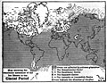 EB1911 Glacial Period Map.jpg 1,069 × 827; 226 KB
-
 EB1911 Manchuria.png 1,584 × 1,888; 837 KB
-
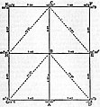 EB1911 Map Projection - Fig. 27.—Plane Table Graticule.jpg 354 × 381; 42 KB
-
 EB1911 North Carolina.jpg 2,472 × 1,834; 2.42 MB
-
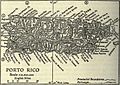 EB1911 Porto Rico.jpg 842 × 599; 196 KB
-
 EB1911 Tibet - southern Tibet.jpg 1,762 × 864; 863 KB
-
 Elmwood Park, Holyoke, Massachusetts (from Richards 1911).jpg 882 × 559; 177 KB
-
 EB 1911 Map Fig 4.png 2,354 × 1,190; 860 KB
-
 EB 1911 Map Fig 5.png 2,346 × 914; 1.7 MB
-
 EB 1911 Map Fig 7.png 1,432 × 1,522; 1.14 MB
-
 EB 1911 Map Fig 9.png 1,950 × 1,572; 648 KB
-
 EB 1911 Map Fig 10.png 1,368 × 1,396; 948 KB
-
 1911 EB Map Fig 11.png 2,266 × 2,276; 2.69 MB
-
 1911 EB Map Fig 12.png 2,214 × 1,980; 2.83 MB
-
 1911 EB Map Fig 13.png 2,266 × 1,156; 1.16 MB
-
 EB 1911 Map Fig 14.png 1,054 × 1,506; 1.12 MB
-
 1911 EB Map Fig 16.png 2,445 × 1,020; 1.42 MB
-
 EB 1911 Map Fig 18.png 2,174 × 1,392; 2.5 MB
-
 EB 1911 Map Fig 19.png 1,724 × 1,320; 1.59 MB
-
 EB 1911 Ptolemy's Map.png 3,916 × 2,166; 3.86 MB
-
 España1212 a 1492.jpg 828 × 642; 530 KB
-
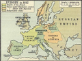 Europe in 1812.PNG 536 × 399; 458 KB
-
 Everglades 1911.jpg 665 × 671; 242 KB
-
 Great Northern Expedition (Berindg-Chirikov 1741 route).png 3,580 × 1,641; 501 KB
-
 Heinrich Kiepert, Palaestina (FL6882107 2367778).jpg 6,158 × 7,716; 78.19 MB
-
 Holyoke Street Railway old carbarn, from Richard's Atlas (1911).jpg 1,049 × 802; 284 KB
-

-
-
 Kaart van Limburg voor 1794 (RAL K 061) (crop Zuid-Limburg).jpg 1,224 × 912; 493 KB
-
 Kaart van Limburg voor 1794 (RAL K 061).jpg 4,000 × 5,133; 5.38 MB
-
 Karachi map 1911.jpg 1,811 × 1,376; 260 KB
-
 Karte Nordostgrönland Koch 1911.png 1,196 × 1,542; 1.46 MB
-
 TK25 Sachsen Messtischblatt 49 Kötzschenbroda, Radebeul 1911.jpg 7,677 × 7,631; 14.83 MB
-
 Lakewood 1911.jpg 639 × 425; 64 KB
-
 Loaita Bank nautical chart of 1911 (cropped).jpg 9,556 × 5,024; 3.18 MB
-
 London Open Air Sanatorium Ordnance Survey map 1911.jpg 4,370 × 3,012; 3.1 MB
-
 Map of Ancient Italy, Southern Part.jpg 1,815 × 1,506; 2.1 MB
-
 Map of Carroll County, Md., showing rural delivery service LOC 2012585334.jpg 9,768 × 10,695; 15.87 MB
-
 Map of Massachusetts showing state highways laid out & petitioned for (7537858042).jpg 2,000 × 1,664; 2.34 MB
-
 Map of Rock Creek Park - December 1911 - (Washington D.C.) LOC 88693048.tif 2,688 × 5,588; 42.97 MB
-
 Map of the permanent system of highways, District of Columbia LOC 80693405.jpg 18,000 × 14,100; 33.21 MB
-
 Map of the permanent system of highways, District of Columbia LOC 87691462.jpg 6,254 × 5,055; 6.34 MB
-
 Mapa Portoviejo 13.07.1911, por Alonso Gonzalez Illescas.jpg 2,519 × 2,806; 4.9 MB
-
 Massachusetts Avenue Heights, Washington, D.C. LOC 88690949.jpg 9,795 × 6,607; 8.38 MB
-
 Massachusetts Avenue Heights, Washington, D.C. LOC 88690949.tif 9,795 × 6,607; 185.15 MB
-
 Medfield Junction interlocking diagram, February 1911.jpg 1,024 × 554; 364 KB
-
 Memorie della Reale accademia delle scienze di Torino (1911) (14773796262).jpg 1,854 × 1,228; 777 KB
-
 Greatest New York (panoramic view) - H. Wellge, sk. NYPL1691404.tiff 7,230 × 4,118; 85.18 MB
-
 NikolaevskoyeAdmiralty.jpg 907 × 753; 140 KB
-

-

-
 North Danger Reef nautical chart of 1911 (cropped).jpg 3,113 × 4,306; 1.05 MB
-
 Plan of Yaroslavl, 1911.jpg 1,153 × 1,500; 511 KB
-
 Planta de Terrenos na 5ª Parada - 1 (1), Acervo do Museu Paulista da USP.jpg 5,412 × 7,216; 19.42 MB
-
 Planta de Terrenos na 5ª Parada - 1 (2), Acervo do Museu Paulista da USP.jpg 5,412 × 7,216; 19.13 MB
-
 Planta de Terrenos na 5ª Parada - 1 (3), Acervo do Museu Paulista da USP.jpg 5,412 × 7,216; 19.26 MB
-
 Planta de Terrenos na 5ª Parada - 3, Acervo do Museu Paulista da USP.jpg 5,412 × 7,216; 19.45 MB
-
 Ponce de leon amusement park 1911.jpg 2,700 × 2,700; 546 KB
-
 Ponce de Leon Park Atlanta 1911 Sanborn map.jpg 803 × 954; 191 KB
-
 Preußen 1440-1795 und 1807-1866.jpg 748 × 899; 181 KB
-
 Putai 1911.png 600 × 470; 732 KB
-
 Jamaica Bay and Rockaway Inlet, Long Island, New York. NYPL1692356.tiff 9,600 × 7,230; 198.61 MB
-
 Railway Ormskirk Skelm St Helens 1911 edited-4.jpg 1,057 × 1,290; 932 KB
-
 Rainfall in England and Wales, 1911.jpg 1,415 × 2,259; 366 KB
-
-
 Romania - soluri si clima - Gheorghe Murgoci.JPG 3,340 × 2,688; 3.17 MB
-
 RomanPowerAsiaMinor90BCE.JPG 762 × 420; 119 KB
-
 Révai nagy lexikona; az ismeretek enciklopédiája (1911) (14580070617).jpg 3,152 × 1,980; 1.4 MB
-
 Révai nagy lexikona; az ismeretek enciklopédiája (1911) (14597983978).jpg 1,418 × 3,170; 515 KB
-
 Révai nagy lexikona; az ismeretek enciklopédiája (1911) (14598111967).jpg 1,864 × 3,062; 815 KB
-
 Révai nagy lexikona; az ismeretek enciklopédiája (1911) (14781481831).jpg 1,572 × 2,856; 565 KB
-
 Révai nagy lexikona; az ismeretek enciklopédiája (1911) (14781483181).jpg 1,970 × 3,283; 1.04 MB
-

-

-
 Shepherd-c-020 cropped Armenia.jpg 451 × 423; 90 KB
-
 Shepherd-c-020.jpg 1,538 × 978; 472 KB
-
 Spezialkarte der Österreichisch-ungarischen Monarchie - Bischoflack und Idria 1911.jpg 14,643 × 11,396; 37.26 MB
-
 Spezialkarte der Österreichisch-ungarischen Monarchie - Eisenkappel und Kanker 1911.jpg 14,717 × 10,650; 34.75 MB
-
 Spezialkarte der Österreichisch-ungarischen Monarchie - Gottschee und Tschernembl 1911.jpg 13,540 × 10,200; 33.33 MB
-
 Spezialkarte der Österreichisch-ungarischen Monarchie - Pettau und Vinica 1911.jpg 14,698 × 11,406; 29.61 MB
-
 Spezialkarte der Österreichisch-ungarischen Monarchie - Radmannsdorf 1911.jpg 14,663 × 11,413; 36.88 MB
-
 Spratly Islands partial nautical charts of 1911.jpg 11,776 × 16,480; 11.87 MB
-

-

-
 The Commercial and financial chronicle (1911) (14595424199).jpg 4,314 × 2,624; 3.01 MB
-
 The Commercial and financial chronicle (1911) (14778989871).jpg 4,232 × 2,464; 2.11 MB
-
 The Commercial and financial chronicle (1911) (14779623474).jpg 4,328 × 2,672; 3.18 MB
-
 The Faroes.jpg 297 × 400; 50 KB
-

-
 The National Geographic Magazine map of Mexico LOC 2010593157.tif 9,973 × 6,928; 197.68 MB
-
 Thitu Reefs and Subi Reef nautical chart of 1911 (cropped).jpg 6,532 × 4,321; 1.91 MB
-
 Tizard Bank nautical chart of 1911 (cropped).jpg 9,559 × 5,312; 3.47 MB
-
 Tour de France 1911 map-fr.svg 1,796 × 1,797; 368 KB
-
 Troyes 1911 plan 06043 (turenne).jpg 407 × 522; 273 KB
-
 Troyes 1911 plan 06043.jpg 3,602 × 2,683; 7.56 MB
-
 United States base map (8345527299).jpg 800 × 521; 84 KB
-
 United States contour map (8346581234).jpg 800 × 517; 89 KB
-
 United States relief map (8345527223).jpg 800 × 516; 90 KB
-
 Velike Pochaivske Lake, 1911.jpg 831 × 831; 248 KB
-
 Williams map of Long Island City section of Queens Borough, New York. LOC 2003630671.jpg 2,659 × 3,412; 1.74 MB
-
 Williams map of Long Island City section of Queens Borough, New York. LOC 2003630671.tif 2,659 × 3,412; 25.96 MB
-
 Yaroslavl (Razdornov) 1911.jpg 7,582 × 9,836; 55.53 MB
-
 Zemly Astrakhanskogo voyska 1911.jpg 2,786 × 3,753; 1.52 MB
-
 Katzenhagen 1911.Ausschnitt Meßtischblatt 2446.jpg 2,426 × 2,026; 1.93 MB
-
 Березкин Д.М. Библейский атлас. (1911). — Палестина во время земной жизни Иисуса Христа.jpg 1,623 × 2,200; 1.81 MB
-

-
 Карта мелитопольского уезда 1911 года.jpg 1,944 × 2,592; 1.71 MB
-
 Руска Рада. Ч. 4. Русини а Москалї. 1911. Руська земля в 1700 роцї.png 2,095 × 1,215; 747 KB
-
 אטלס תנך 15 (FL170208376 3565668).jpg 5,250 × 3,315; 18 MB
-
 אטלס תנך 16 (FL170208377 3565668).jpg 2,789 × 4,317; 9.24 MB


.jpg)


_(19727029934).jpg)
.jpg)


_(14776742434).jpg)


_(20261763940).jpg)


_(20628420546).jpg)


.jpg)


.png)
.jpg)
.jpg)

_(crop_Zuid-Limburg).jpg)
.jpg)


.jpg)


.jpg)


_(14773796262).jpg)

_LOC_2011587112.jpg)
.jpg)

,_Acervo_do_Museu_Paulista_da_USP.jpg)
,_Acervo_do_Museu_Paulista_da_USP.jpg)
,_Acervo_do_Museu_Paulista_da_USP.jpg)


_(page_10_crop).jpg)


_(14580070617).jpg)
_(14597983978).jpg)
_(14598111967).jpg)
_(14781481831).jpg)
_(14781483181).jpg)


_(14595424199).jpg)
_(14778989871).jpg)
_(14779623474).jpg)


.jpg)
.jpg)

.jpg)

.jpg)
.jpg)
.jpg)


_1911.jpg)


._%E2%80%94_%D0%9F%D0%B0%D0%BB%D0%B5%D1%81%D1%82%D0%B8%D0%BD%D0%B0_%D0%B2%D0%BE_%D0%B2%D1%80%D0%B5%D0%BC%D1%8F_%D0%B7%D0%B5%D0%BC%D0%BD%D0%BE%D0%B9_%D0%B6%D0%B8%D0%B7%D0%BD%D0%B8_%D0%98%D0%B8%D1%81%D1%83%D1%81%D0%B0_%D0%A5%D1%80%D0%B8%D1%81%D1%82%D0%B0.jpg)
.jpg)


.jpg)
.jpg)