Category:1911 maps of Washington, D.C.
States of the United States: California · Connecticut · Delaware · Idaho · Illinois · Iowa · Kansas · Louisiana · Massachusetts · Michigan · Minnesota · Missouri · New York · Ohio · Oklahoma · Pennsylvania · Rhode Island · South Carolina · South Dakota · Texas · Utah · Virginia · West Virginia · Wisconsin · Wyoming – Washington, D.C.
| ← 1910 1911 1913 1914 1915 1916 1917 1918 1919 → |
Media in category "1911 maps of Washington, D.C."
The following 3 files are in this category, out of 3 total.
-
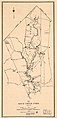 Map of Rock Creek Park - December 1911 - (Washington D.C.) LOC 88693048.jpg 2,688 × 5,588; 2.05 MB
-
 Map of the permanent system of highways, District of Columbia LOC 80692284.jpg 6,010 × 5,167; 6.2 MB
-
 Map of the permanent system of highways, District of Columbia LOC 87691463.jpg 6,264 × 5,023; 5.89 MB
_LOC_88693048.jpg)

