Category:1913 maps of Oceania
Temperate regions: North America · South America · Africa · Europe · Asia · Oceania – Polar regions: – Other regions:
English: 1913 maps of Oceania
Media in category "1913 maps of Oceania"
The following 4 files are in this category, out of 4 total.
-
An atlas of commercial geography (1913) (14594767000).jpg 2,880 × 2,412; 1.63 MB
-
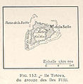
FMIB 36943 Ile Totoya, du Groupe des Iles Fijii.jpeg 375 × 383; 26 KB
-
Map of Murraylands railway lines (South Australian Railways) 1913.jpg 890 × 933; 165 KB


