Category:1920s maps of Boston
Subcategories
This category has the following 2 subcategories, out of 2 total.
Media in category "1920s maps of Boston"
The following 16 files are in this category, out of 16 total.
-
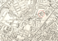
 1921 Embankment map Boston bySampson Murdock BPL 12593 detail.png 1,058 × 739; 1.65 MB
-
 1921 HuntingtonAve map Boston bySampson Murdock BPL 12593 detail.png 1,030 × 742; 1.49 MB
-
 Ft-Heath-Map-1921.jpg 678 × 464; 133 KB
-
 1921 OperaHouse HuntingtonAve map Boston bySampson Murdock BPL 12593 detail.png 1,030 × 742; 1.5 MB
-
 1925 City of Boston rapid transit lines map.png 2,328 × 3,500; 7.78 MB
-
 1926 Cornhill map Boston BPL12989 detail.png 809 × 713; 953 KB
-
 1927 Boston Elevated Railway system map.png 2,474 × 3,500; 12.54 MB
-
 Boston traffic map showing one way streets and parking spaces (6093642349).jpg 2,000 × 1,381; 2.75 MB
-

-
 Columbus Park (7537865504).jpg 2,000 × 1,428; 2.27 MB
-
 Dorchester Rapid Transit plan 1923.jpg 2,399 × 3,302; 1.07 MB
-
 Map of the city of Boston Massachusetts (3886420075).jpg 1,796 × 2,000; 2.63 MB
-
 Map showing Metropolitan Sewerage District (2675094148).jpg 1,532 × 2,000; 2.92 MB
-
 Medford st ward map 1922.jpg 750 × 524; 124 KB
-
 Navy yard ward map 1922.jpg 750 × 524; 82 KB
-


.jpg)
.jpg)
.jpg)
.jpg)
.jpg)


.jpg)