Category:1920s maps of Denmark
Countries of Europe: Albania · Armenia‡ · Austria · Azerbaijan‡ · Belarus · Belgium · Bosnia and Herzegovina · Bulgaria · Croatia · Czech Republic · Denmark · Estonia · Finland · France‡ · Georgia‡ · Germany · Greece · Hungary · Iceland · Republic of Ireland · Italy · Latvia · Lithuania · Luxembourg · Montenegro · Netherlands‡ · Norway · Poland · Portugal‡ · Romania · Russia‡ · Serbia · Slovenia · Spain‡ · Sweden · Switzerland · Turkey‡ · Ukraine · United Kingdom
‡: partly located in Europe
‡: partly located in Europe
Subcategories
This category has the following 2 subcategories, out of 2 total.
.
Media in category "1920s maps of Denmark"
The following 11 files are in this category, out of 11 total.
-
 Collier's 1921 Denmark.jpg 1,888 × 2,290; 1.47 MB
-
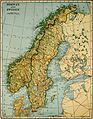 Collier's 1921 Norway - Map of Norway and Sweden.jpg 1,798 × 2,308; 1.3 MB
-

-
 Denmark 1921.jpg 1,533 × 2,163; 791 KB
-
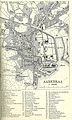 Aabenraa 1923.jpg 1,352 × 2,255; 2.5 MB
-
 Bahnhof Schmedeby 1929.jpg 937 × 623; 307 KB
-
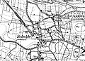 Lage Bahnhof Schelde.jpg 810 × 585; 307 KB
-
 Egebæksvang 1928.png 697 × 504; 459 KB
-
 PostruterDanmark1.jpg 736 × 993; 197 KB
-
 PostruterDanmark2.jpg 758 × 832; 143 KB
-
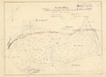
 Sonderjylland1918.jpg 4,790 × 5,417; 9.31 MB


_(14777419672).jpg)


