Category:1920s maps of Java
Media in category "1920s maps of Java"
The following 12 files are in this category, out of 12 total.
-
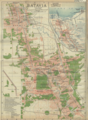 Batavia, 1920.png 1,174 × 1,596; 1.31 MB
-
 Peta Jawa Barat 1922.jpg 581 × 304; 31 KB
-
 Karesidenan Indramayu.jpg 855 × 1,647; 445 KB
-
 Peta Karesidenan Cheribon VOC.jpg 751 × 1,000; 204 KB
-
 Peta Pulau Jawa 1922.jpg 3,232 × 1,689; 735 KB
-
 Peta Pulau Jawa 38 Karesidenan Jawa & Madura 1930.jpg 1,351 × 401; 85 KB
-
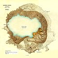
 Bromo-Topogr-Dienst.JPG 460 × 600; 136 KB
-

-
 Ijen-kawah.JPG 1,273 × 1,004; 458 KB
-

-

-
 Kawah Ijen.JPG 1,503 × 1,500; 516 KB


