Category:1920s maps of New Orleans
Media in category "1920s maps of New Orleans"
The following 4 files are in this category, out of 4 total.
-
 IHNC Lock & Vicinity 1920.jpg 4,509 × 3,034; 4.55 MB
-
 Inner Harbor Navigation Canal, general map LOC 89697257.jpg 6,235 × 3,773; 3.35 MB
-
 Inner Harbor Navigation Canal, general map LOC 89697257.tif 6,235 × 3,773; 67.3 MB
-
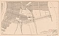
 New Orleans Quarter CBD 1920 map.jpg 691 × 705; 143 KB


