Category:1921 maps of Louisiana
States of the United States: California · Delaware · Hawaii · Idaho · Illinois · Iowa · Louisiana · Maryland · Massachusetts · Michigan · Minnesota · New York · Ohio · Pennsylvania · South Carolina · South Dakota · Texas · Utah · Virginia · West Virginia · Wyoming
| ← 1920 1921 1922 1923 |
Media in category "1921 maps of Louisiana"
The following 15 files are in this category, out of 15 total.
-
 Collier's 1921 Louisiana.jpg 2,425 × 1,979; 1.19 MB
-

-
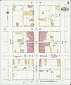
 Sanborn Fire Insurance Map from Junction City, Union County, Arkansas. LOC sanborn00275 003-1.tif 8,600 × 10,200; 250.97 MB
-

-
 Sanborn Fire Insurance Map from Junction City, Union County, Arkansas. LOC sanborn00275 003-2.tif 8,600 × 10,200; 250.97 MB
-

-
 Sanborn Fire Insurance Map from Junction City, Union County, Arkansas. LOC sanborn00275 003-3.tif 8,600 × 10,200; 250.97 MB
-

-
 Sanborn Fire Insurance Map from Junction City, Union County, Arkansas. LOC sanborn00275 003-4.tif 8,600 × 10,200; 250.97 MB
-
-
 Sanborn Fire Insurance Map from Junction City, Union County, Arkansas. LOC sanborn00275 003-5.tif 8,600 × 10,200; 250.97 MB
-

-
 Sanborn Fire Insurance Map from Junction City, Union County, Arkansas. LOC sanborn00275 003-6.tif 8,600 × 10,200; 250.97 MB
-

-
 Sanborn Fire Insurance Map from Junction City, Union County, Arkansas. LOC sanborn00275 003-7.tif 8,600 × 10,200; 250.97 MB


