Category:1927 maps of California
States of the United States: California · Delaware · Hawaii · Idaho · Illinois · Iowa · Kansas · Massachusetts · Michigan · Minnesota · New Hampshire · North Dakota · Virginia · Wisconsin · Wyoming – Washington, D.C.
| ← 1920 1921 1922 1923 1927 1928 1929 |
Media in category "1927 maps of California"
The following 3 files are in this category, out of 3 total.
-
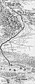 Los Angeles Aqueduct route, 1927.jpg 3,099 × 7,394; 2.04 MB
-
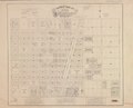
 Official map of the City of Brawley, Imperial County, California LOC 2006635242.jpg 7,942 × 6,423; 5.76 MB
-
 Official map of the City of Brawley, Imperial County, California LOC 2006635242.tif 7,942 × 6,423; 145.95 MB

