Category:1928 maps of the world
Media in category "1928 maps of the world"
The following 6 files are in this category, out of 6 total.
-
 Admiralty Chart No 3778 Telegraph chart of the world, Published 1928.tiff 7,267 × 10,473; 217.78 MB
-
 Map showing the overland and overseas flights of Charles A. Lindbergh (35048888011) (2).jpg 2,000 × 1,186; 2.77 MB
-
 Rand McNally Historical Flight Map, 1928.jpg 5,030 × 3,487; 5.34 MB
-

-
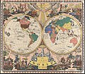 The new map of the world (35048886711).jpg 2,000 × 1,757; 3.86 MB
-
 World Map from the Atlas of the USSR published in 1928.jpg 7,640 × 4,121; 15.66 MB
_(2).jpg)


.jpg)
