Category:1929 maps of Idaho
States of the United States: California · Idaho · Illinois · Iowa · Kentucky · Maryland · Massachusetts · Michigan · Minnesota · New Jersey · Pennsylvania · Rhode Island · Utah · Wisconsin · Wyoming – Washington, D.C.
| 1920 1921 1922 1925 1927 1928 1929 → |
Subcategories
This category has the following 6 subcategories, out of 6 total.
S
Media in category "1929 maps of Idaho"
The following 21 files are in this category, out of 21 total.
-
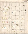
 Sanborn Fire Insurance Map from Ashton, Fremont County, Idaho, 1929, Plate 0001.jpg 6,450 × 7,650; 4.36 MB
-
 Sanborn Fire Insurance Map from Ashton, Fremont County, Idaho, 1929, Plate 0001.tiff 6,450 × 7,650; 141.17 MB
-
 Sanborn Fire Insurance Map from Ashton, Fremont County, Idaho, 1929, Plate 0002.jpg 6,450 × 7,650; 3.11 MB
-
 Sanborn Fire Insurance Map from Ashton, Fremont County, Idaho, 1929, Plate 0002.tiff 6,450 × 7,650; 141.17 MB
-
 Sanborn Fire Insurance Map from Ashton, Fremont County, Idaho, 1929, Plate 0003.jpg 6,450 × 7,650; 3.69 MB
-
 Sanborn Fire Insurance Map from Ashton, Fremont County, Idaho, 1929, Plate 0003.tiff 6,450 × 7,650; 141.17 MB
-
 Sanborn Fire Insurance Map from Ashton, Fremont County, Idaho, 1929, Plate 0004.jpg 6,450 × 7,650; 3.31 MB
-
 Sanborn Fire Insurance Map from Ashton, Fremont County, Idaho, 1929, Plate 0004.tiff 6,450 × 7,650; 141.17 MB
-
 Sanborn Fire Insurance Map from Ashton, Fremont County, Idaho, 1929, Plate 0005.jpg 6,450 × 7,650; 3.03 MB
-
 Sanborn Fire Insurance Map from Ashton, Fremont County, Idaho, 1929, Plate 0005.tiff 6,450 × 7,650; 141.17 MB
-
 Sanborn Fire Insurance Map from Ferdinand, Idaho County, Idaho, 1929, Plate 0001.jpg 6,450 × 7,650; 3.65 MB
-
 Sanborn Fire Insurance Map from Ferdinand, Idaho County, Idaho, 1929, Plate 0001.tiff 6,450 × 7,650; 141.17 MB
-
 Sanborn Fire Insurance Map from McCammon, Bannock County, Idaho, 1929, Plate 0001.jpg 6,450 × 7,650; 3.97 MB
-
 Sanborn Fire Insurance Map from McCammon, Bannock County, Idaho, 1929, Plate 0001.tiff 6,450 × 7,650; 141.17 MB
-
 Sanborn Fire Insurance Map from Reubens, Lewis County, Idaho, 1929, Plate 0001.jpg 6,450 × 7,650; 3.63 MB
-
 Sanborn Fire Insurance Map from Stites, Idaho County, Idaho, 1929, Plate 0001.jpg 6,450 × 7,650; 4.13 MB
-
 Sanborn Fire Insurance Map from Stites, Idaho County, Idaho, 1929, Plate 0001.tiff 6,450 × 7,650; 141.17 MB
-
 Sanborn Fire Insurance Map from Weston, Franklin County, Idaho, 1929, Plate 0001.jpg 6,450 × 7,650; 3.33 MB
-
 Sanborn Fire Insurance Map from Weston, Franklin County, Idaho, 1929, Plate 0001.tiff 6,450 × 7,650; 141.17 MB
-
 Sanborn Fire Insurance Map from White Bird, Idaho County, Idaho, 1929, Plate 0001.jpg 6,450 × 7,650; 3.81 MB
-
 Sanborn Fire Insurance Map from White Bird, Idaho County, Idaho, 1929, Plate 0001.tiff 6,450 × 7,650; 141.17 MB


