Category:1930 maps of Africa
Temperate regions: North America · South America · Africa · Europe · Asia · – Polar regions: – Other regions:
| ← 1930 1931 1932 1933 1934 1935 1936 1937 1938 1939 → |
Media in category "1930 maps of Africa"
The following 7 files are in this category, out of 7 total.
-
 Afrique du Nord - Centrales, réseaux de distribution, lignes de transport - btv1b532133202.jpg 25,908 × 9,631; 29.66 MB
-
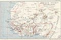 Afrique occidentale française - btv1b8458911t.jpg 5,105 × 3,344; 2.48 MB
-
 Afrique équatoriale française - btv1b84589127.jpg 3,203 × 5,218; 2.44 MB
-

-
 Cook's Travellers map of South Africa. 160 miles - btv1b84598994.jpg 6,096 × 7,881; 5.36 MB
-
 Horn1930ad.png 1,110 × 1,327; 120 KB
-


_A._Meunier_-_btv1b532133526.jpg)


_A._Meunier_-_btv1b53213353n.jpg)