Category:1930s maps of Schleswig-Holstein
|
Federal states of Germany: |
Media in category "1930s maps of Schleswig-Holstein"
The following 2 files are in this category, out of 2 total.
-
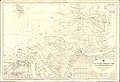 Admiralty Chart No 1875 Jade River to Norder Piep, Published 1934.jpg 16,496 × 11,267; 53.75 MB
-
 Lange diercke sachsen deutsche landschaften wattenkueste.jpg 1,235 × 2,057; 1.14 MB

