Category:1939 maps of Asia
Temperate regions: North America · South America · Africa · Europe · Asia · Oceania – Polar regions: – Other regions:
English: 1939 maps of Asia
Español: Mapas de Asia en 1939
Subcategories
This category has the following 5 subcategories, out of 5 total.
C
- 1939 maps of Cambodia (2 F)
I
- 1939 maps of India (empty)
L
- 1939 maps of Laos (2 F)
T
- 1939 maps of Taiwan (12 F)
V
- 1939 maps of Vietnam (2 F)
Media in category "1939 maps of Asia"
The following 10 files are in this category, out of 10 total.
-
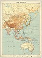
 1939 Ouya Zongtu.jpg 3,510 × 2,717; 1.7 MB
-

-
-
 Korea map 1939-es.svg 634 × 387; 1.31 MB
-
 Korea map 1939-hu.svg 634 × 387; 2.2 MB
-
 Korea map 1939.svg 634 × 387; 2.23 MB
-
 Manchukuo map 1939-es.svg 634 × 387; 1.32 MB
-
 Manchukuo map 1939.svg 634 × 387; 2.27 MB
-
 Mittelasien BV044859949.jpg 4,500 × 3,165; 1.86 MB
-
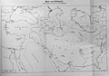
 Old german map of Asia.jpg 1,444 × 953; 707 KB

.jpg)


