Category:1940s maps of Oceania
Temperate regions: North America · South America · Africa · Europe · Asia · Oceania – Polar regions: – Other regions:
Subcategories
This category has the following 10 subcategories, out of 10 total.
- 1941 maps of Oceania (2 F)
- 1942 maps of Oceania (7 F)
- 1944 maps of Oceania (4 F)
- 1949 maps of Oceania (2 F)
A
- 1940s maps of Australia (12 F)
H
S
Media in category "1940s maps of Oceania"
The following 7 files are in this category, out of 7 total.
-
 190 weeks.jpg 984 × 1,326; 577 KB
-
 NavWarMap No. 5 - Southwest Pacific.jpg 9,000 × 6,105; 9.29 MB
-
 Hawaiian and Outlying Islands.jpg 2,408 × 1,817; 510 KB
-
 Oceânia politica - traçado por J. Forest... - btv1b53189366c.jpg 15,981 × 12,198; 33.36 MB
-
 Map of the Central Pacific.jpg 4,304 × 2,713; 1.05 MB
-
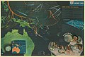
 Target Tokyo.jpg 968 × 912; 308 KB
-
 The South Pacific Islands.jpg 991 × 552; 114 KB


