Category:1942 maps
| ← · 1940 · 1941 · 1942 · 1943 · 1944 · 1945 · 1946 · 1947 · 1948 · 1949 · → |
Deutsch: Karten mit Bezug zum Jahr 1942
English: Maps related to the year 1942
Español: Mapas relativos al año 1942
Français : Cartes concernant l’an 1942
Русский: Карты 1942 года
Subcategories
This category has the following 8 subcategories, out of 8 total.
Media in category "1942 maps"
The following 94 files are in this category, out of 94 total.
-
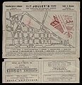
 1942 map of Albertville, Alabama.jpeg 3,283 × 2,829; 627 KB
-
 A Map of the Pan American republics.jpg 5,403 × 8,270; 4.29 MB
-
 Atlantic arena, 1942.jpg 3,394 × 2,684; 2.87 MB
-
 Bir Sejri (FL155910623 4084190).jpg 13,627 × 15,159; 188.25 MB
-
 Budapest Székesföváros Térképe 01 (FL35076826 2552118).jpg 12,223 × 17,783; 276.2 MB
-
 Budapest Székesföváros Térképe 02 (FL35076827 2552118).jpg 12,184 × 17,622; 274.32 MB
-
 Cairo Tramways 01-map (FL50290394 4048653).jpg 6,642 × 4,870; 42.16 MB
-
 Cairo Tramways 02-verso (FL50290395 4048653).jpg 6,742 × 4,855; 42.44 MB
-
 Caribe v42.jpg 1,200 × 720; 143 KB
-
 Cvtimetable1942may241942.jpg 3,513 × 3,781; 4.28 MB
-
 Fiq-Haifa (FL25567982 2369453).jpg 14,670 × 10,884; 210.35 MB
-
 Great Britain army 512 Field Survey Company, Bir el Ma'ein (FL155909097 4073182).jpg 19,350 × 13,352; 291.98 MB
-
 Great Britain army 517 Field Survey Company, Amrawa (FL28962197 3857132).jpg 11,556 × 14,512; 223.7 MB
-
 Great Britain army 517 Field Survey Company, Baniass (FL28957834 3856988).jpg 11,676 × 14,596; 215.53 MB
-
 Great Britain army 517 Field Survey Company, Beit Yafa (FL28957882 3857009).jpg 11,473 × 14,542; 230.53 MB
-
 Great Britain army 517 Field Survey Company, Cheikh Aali (FL28957822 3856952).jpg 11,556 × 14,482; 218.8 MB
-
 Great Britain army 517 Field Survey Company, Deir Srass (FL28957829 3856973).jpg 11,620 × 14,518; 224.38 MB
-
 Great Britain army 517 Field Survey Company, El Hamme (FL28957875 3856910).jpg 11,532 × 14,443; 232.6 MB
-
 Great Britain army 517 Field Survey Company, Es Safa (FL27981267 3808148).jpg 11,822 × 14,672; 182.6 MB
-
 Great Britain army 517 Field Survey Company, Es Salihiya (FL28957844 3856905).jpg 11,537 × 14,603; 218.15 MB
-
 Great Britain army 517 Field Survey Company, Et Tabigha (FL28957764 3856901).jpg 11,531 × 14,453; 217.08 MB
-
 Great Britain army 517 Field Survey Company, Fiq (FL28957818 3856912).jpg 11,490 × 14,426; 233.36 MB
-
 Great Britain army 517 Field Survey Company, Harima (FL28962206 3857128).jpg 11,520 × 14,376; 225.98 MB
-
 Great Britain army 517 Field Survey Company, Jisr Esh Sh. Husein (FL27981277 3808188).jpg 11,584 × 14,504; 185.45 MB
-
 Great Britain army 517 Field Survey Company, Kafer el Ma (FL28962673 3857118).jpg 11,471 × 14,343; 227.26 MB
-
 Great Britain army 517 Field Survey Company, Kisrine (FL28957885 3856963).jpg 11,492 × 14,452; 208.71 MB
-
 Great Britain army 517 Field Survey Company, Kittim (FL28962186 3857123).jpg 11,433 × 14,362; 226.51 MB
-
 Great Britain army 517 Field Survey Company, Metulla (FL28957794 3856906).jpg 11,577 × 14,487; 224.16 MB
-
 Great Britain army 517 Field Survey Company, Qanaabe (FL28957900 3856987).jpg 11,631 × 14,622; 237.16 MB
-
 Great Britain army 517 Field Survey Company, Rosh Pinna (FL28957777 3856903).jpg 11,617 × 14,509; 208.4 MB
-
 Great Britain army 517 Field Survey Company, Samakh (FL28955898 3856898).jpg 11,509 × 14,506; 209.61 MB
-
 Great Britain army 517 Field Survey Company, Som (FL28962189 3857105).jpg 11,655 × 14,520; 228.64 MB
-
 Great Britain army 517 Field Survey Company, Taibe (FL28957859 3856908).jpg 11,591 × 14,246; 220.73 MB
-
 Great Britain army 517 Field Survey Company, Tiberias (FL28955923 3856900).jpg 11,431 × 14,485; 216.95 MB
-
 Great Britain Army, Enn Naqoura (FL27975802 3805157).jpg 14,173 × 13,505; 292.56 MB
-
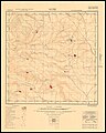
 Great Britain Geographical Section (War office, General Staff), North Sinai (FL147392167 2367711).jpg 14,310 × 17,803; 277.31 MB
-
 Kenilworth Aquatic Gardens - (Washington D.C.) LOC 88690874.jpg 6,160 × 5,597; 4.91 MB
-
 Kenilworth Aquatic Gardens - (Washington D.C.) LOC 88690874.tif 6,160 × 5,597; 98.64 MB
-

-

-
 Map of Guangzhou 1942.jpg 1,144 × 876; 274 KB
-
 Hessen Meßtischblatt 5118 Marburg 1942.jpg 1,600 × 1,460; 1.01 MB
-

-
 Outline map of Cairo (FL33127546 2370333).jpg 21,563 × 15,854; 440.43 MB
-
 Pacific arena, 1942.jpg 6,094 × 4,879; 6.31 MB
-
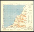
 Palestine (FL28956051 2699827).jpg 13,859 × 21,969; 430.43 MB
-
 Palestine 01-map (FL37251376 2685733).jpg 9,872 × 15,099; 208.29 MB
-
 Palestine 02-cover (FL37251395 2685733).jpg 3,035 × 4,292; 16.55 MB
-
 Palestine Potash Limited, Sketch map of Wadi el Hasa.Dead sea south (FL147448619 4130087).jpg 17,282 × 9,004; 161.42 MB
-
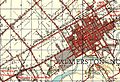 Palmerston North 1942 map.jpg 1,327 × 911; 784 KB
-
 Reber Plan.jpg 2,220 × 3,184; 1.12 MB
-
 Rock Creek Park - (Washington D.C.). LOC 88693076.jpg 8,559 × 6,123; 7.1 MB
-
 Rock Creek Park - (Washington D.C.). LOC 88693076.tif 8,559 × 6,123; 149.94 MB
-
 Route map of Cairo 01-map (FL50290386 4048652).jpg 6,711 × 4,977; 41.22 MB
-
 Route map of Cairo 02-verso (FL50290389 4048652).jpg 6,811 × 7,050; 61.54 MB
-
 Rrand McNally map of the Mediterranean lands (FL155340221 3374992).jpg 16,845 × 8,515; 144.82 MB
-
 Stalingrad - Preparations for Operation Uranus.png 4,321 × 2,660; 2.83 MB
-
 Stalingrad - Uranus SVG-hu.svg 4,321 × 2,660; 2.41 MB
-
 Stalingrad - Uranus SVG.svg 4,321 × 2,660; 2.42 MB
-
 Survey of Palestine, Anabta (FL27975780 3805147).jpg 11,862 × 15,656; 263.43 MB
-
 Survey of Palestine, Baqa el Gharbiya (FL27977886 3805123).jpg 11,510 × 14,060; 183.34 MB
-
 Survey of Palestine, Bardala (FL27979209 3808103).jpg 14,618 × 17,319; 329.56 MB
-
 Survey of Palestine, Beersheba (FL60507286 3809584).jpg 15,586 × 12,804; 221.67 MB
-
 Survey of Palestine, Cæsarea (FL28027725 3805118).jpg 11,071 × 12,169; 159.15 MB
-
 Survey of Palestine, Dead Sea (FL60505882 3809555).jpg 15,816 × 12,802; 221.13 MB
-
 Survey of Palestine, Gaza (FL60505072 3808993).jpg 15,798 × 12,798; 222.27 MB
-
 Survey of Palestine, Haifa (FL54735238 3808346).jpg 14,382 × 11,436; 233.6 MB
-
 Survey of Palestine, Hebron (FL60505840 3809538).jpg 15,922 × 12,950; 237.5 MB
-
 Survey of Palestine, Jaba (FL27979245 3807095).jpg 12,175 × 15,919; 243.66 MB
-
 Survey of Palestine, Jaffa Tel Aviv (FL54739350 3808558).jpg 14,180 × 11,354; 231.77 MB
-
 Survey of Palestine, Jebel Usdum (FL60507474 3809602).jpg 15,942 × 12,928; 229.06 MB
-
 Survey of Palestine, Jericho (FL27979203 3808043).jpg 11,665 × 14,531; 181.37 MB
-
 Survey of Palestine, Jerusalem (FL60505029 3808982).jpg 15,696 × 12,774; 222.37 MB
-
 Survey of Palestine, Khirbat Beit Lid (FL62919423 3523443).jpg 12,138 × 15,680; 195.21 MB
-
 Survey of Palestine, Locust map - Jerusalem centre (FL147408849 2673920).jpg 17,973 × 12,017; 202.12 MB
-
 Survey of Palestine, Nablus (FL60504944 3808662).jpg 16,202 × 13,224; 241.46 MB
-
 Survey of Palestine, Nazareth (FL54739324 3808528).jpg 14,844 × 11,865; 263.19 MB
-
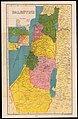
 Survey of Palestine, Palestine (FL37251644 3249893).jpg 15,732 × 21,805; 451.76 MB
-
 Survey of Palestine, Rafah (FL60505849 3809559).jpg 15,800 × 12,908; 229.9 MB
-
 Survey of Palestine, Ramle (FL60504978 3808935).jpg 15,850 × 12,856; 232.15 MB
-
 Survey of Palestine, Sabastiya (FL27975760 3805145).jpg 12,026 × 15,454; 258.29 MB
-
 Survey of Palestine, Safad (FL54735312 3808406).jpg 14,328 × 11,364; 239.71 MB
-
 Survey of Palestine, Wadi el Maliaha (FL27979178 3808046).jpg 11,481 × 14,300; 172.55 MB
-
 Survey of Palestine, Yibna (FL60504966 3808672).jpg 17,100 × 14,096; 252.64 MB
-
 Survey of Palestine, Zikhron Ya'aqov (FL54739311 3808473).jpg 14,340 × 11,567; 239.48 MB
-
 The modern Palestine 01-cover (FL45605254 3943077).jpg 2,934 × 1,934; 1.39 MB
-
 The modern Palestine 02-map (FL45605262 3943077).jpg 2,086 × 3,736; 1.91 MB
-
 The old and the new Judean settlements (FL191853582 1108519).jpg 4,146 × 2,733; 8.72 MB
-
 The War Department Pentagon Building and environs LOC 89692630.jpg 4,809 × 6,605; 3.08 MB
-
 The War Department Pentagon Building and environs LOC 89692630.tif 4,809 × 6,605; 90.88 MB
-
 Topographic Map, Acadia National Park and vicinity, Hancock County, Maine. LOC 99446120.jpg 10,470 × 11,366; 18.26 MB
-
 Zakiye (FL155196585 4087032).jpg 14,548 × 11,636; 165.44 MB
-
 מפת שטח סכימטית, אזור לטרון (FL159700125 3751371).jpg 12,522 × 14,337; 194.72 MB
-
 خريطة الرباط سلا 1942.jpg 4,378 × 5,966; 7.76 MB


.jpg)
.jpg)
.jpg)
.jpg)
.jpg)


.jpg)
.jpg)
.jpg)
.jpg)
.jpg)
.jpg)
.jpg)
.jpg)
.jpg)
.jpg)
.jpg)
.jpg)
.jpg)
.jpg)
.jpg)
.jpg)
.jpg)
.jpg)
.jpg)
.jpg)
.jpg)
.jpg)
.jpg)
.jpg)
.jpg)
,_North_Sinai_(FL147392167_2367711).jpg)
_LOC_88690874.jpg)


.jpg)
.jpg)

.jpg)
.jpg)
.jpg)
.jpg)


._LOC_88693076.jpg)
.jpg)
.jpg)
.jpg)


.jpg)
.jpg)
.jpg)
.jpg)
.jpg)
.jpg)
.jpg)
.jpg)
.jpg)
.jpg)
.jpg)
.jpg)
.jpg)
.jpg)
.jpg)
.jpg)
.jpg)
.jpg)
.jpg)
.jpg)
.jpg)
.jpg)
.jpg)
.jpg)
.jpg)
.jpg)
.jpg)
.jpg)
.jpg)


.jpg)
.jpg)
