Category:1942 maps of Norway
Countries of Europe: Bosnia and Herzegovina · France‡ · Germany · Lithuania · Norway · Romania · Turkey‡ · Ukraine · United Kingdom
‡: partly located in Europe
‡: partly located in Europe
English: 1942 maps made in Norway or from Norway or showing history of Norway
Media in category "1942 maps of Norway"
The following 24 files are in this category, out of 24 total.
-
 Gradteigsmålinger A31-11, Sogn og Fjordane, 1942.jpg 7,335 × 7,561; 5.46 MB
-
 Gradteigsmålinger A31-4-n-2, Sogn og Fjordane, 1942.jpg 7,109 × 7,316; 4.67 MB
-
 Gradteigsmålinger A31-4-s-2, Sogn og Fjordane, 1942.jpg 7,294 × 7,507; 6.05 MB
-
 Gradteigsmålinger A31-5, Sogn og Fjordane, 1942.jpg 7,219 × 7,368; 6.81 MB
-
 Gradteigsmålinger A32-10, Hordaland, 1942.jpg 7,108 × 6,917; 5.88 MB
-
 Gradteigsmålinger A32-11, Hordaland, 1942.jpg 7,254 × 7,372; 6.13 MB
-
 Gradteigsmålinger A32-12, Sogn og Fjordane, 1942.jpg 7,422 × 7,571; 5.61 MB
-
 Gradteigsmålinger G35-10, Akershus, 1942.jpg 6,815 × 7,299; 5.31 MB
-
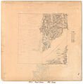
 Kart over Nordre Bergenhus Amt (sø), 1942.jpg 8,031 × 6,691; 11.06 MB
-
 Kart over Romsdals Amt (nø), 1942.jpg 7,866 × 6,780; 9.68 MB
-
 Kart over Romsdals Amt (sø), 1942.jpg 8,256 × 6,767; 9.76 MB
-
 Landgeneralkart 14, Lofoten, 1942.jpg 6,828 × 6,574; 7.52 MB
-
 Landgeneralkart 35, Trondheim, 1942.jpg 5,582 × 6,656; 7.62 MB
-
 Landgeneralkart 55, Oslo, 1942.jpg 6,304 × 6,567; 7.74 MB
-
 Topographic map of Norway, A33 aust Herdla, 1942.jpg 4,372 × 4,984; 4.01 MB
-
 Topographic map of Norway, H12, I12 Røst, 1942.jpg 5,559 × 5,302; 3.92 MB
-
 Topographic map of Norway, K10 Svolvær, 1942.jpg 7,016 × 5,417; 5.99 MB
-
 Topographic map of Norway, K15 Dunderlandsdalen, 1942.jpg 5,919 × 5,393; 8.75 MB
-
 Topographic map of Norway, L13 Saltdal, 1942.jpg 6,465 × 5,136; 8.45 MB
-
 Topographic map of Norway, L14 Junkerdalen, 1942.jpg 7,137 × 6,306; 7.21 MB
-
 Topographic map of Norway, M7 Bjarkøy, 1942.jpg 5,187 × 5,682; 4.69 MB
-
 Topographic map of Norway, T2 Galten, 1942.jpg 5,741 × 5,732; 4.08 MB
-
 Topographic map of Norway, W4 Børselv, 1942.jpg 5,757 × 5,673; 6.05 MB
-
 Topographic map of Norway, X5 Rastigaissa, 1942.jpg 5,851 × 5,272; 3.66 MB


,_1942.jpg)
,_1942.jpg)
,_1942.jpg)


