Category:1946 maps of South America
Temperate regions: North America · South America · Africa · Europe · Asia · – Polar regions: – Other regions:
| ← 1940 1941 1942 1943 1944 1945 1946 1947 1948 1949 → |
Media in category "1946 maps of South America"
The following 4 files are in this category, out of 4 total.
-
 Bulletin (1946) (20241421089).jpg 2,112 × 3,244; 1.24 MB
-
 Bulletin (1946) (20434258511).jpg 4,368 × 1,864; 1,002 KB
-
 Index Map D000 South America - DPLA - f85efe927e50edf7793834b6f353d778.jpg 7,210 × 10,327; 6.5 MB
-
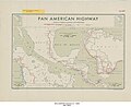 Pan American Highway - DPLA - 7f0fcead9e4524c25c1d3efc9dde78b7.jpg 6,610 × 5,374; 3.2 MB
_(20241421089).jpg)
_(20434258511).jpg)

