Category:1950 maps of Hungary
Countries of Europe: Albania · Austria · Belgium · Denmark · France‡ · Hungary · Republic of Ireland · Lithuania · Luxembourg · Norway · Poland · Romania · Russia‡ · Spain‡ · Sweden · Switzerland · Ukraine · United Kingdom
‡: partly located in Europe
‡: partly located in Europe
| 1950 |
Media in category "1950 maps of Hungary"
The following 7 files are in this category, out of 7 total.
-
 Hungary - DPLA - 3f2c2d3558f645ec97d94a4a26027b00.jpg 11,962 × 8,681; 11.25 MB
-
 Hungary - DPLA - 66b6f64a90e6e9beb949b6f00c0f03c9.jpg 11,960 × 8,686; 9.42 MB
-
 Hungary - DPLA - c6517972ea92f590f3acd272f042a7a0.jpg 11,964 × 8,673; 10.41 MB
-
 Hungary - DPLA - df0b39b37199dec2571bb4df2c6f96fb.jpg 11,962 × 8,677; 11.21 MB
-
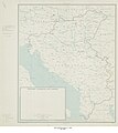
 Hungary, Yugoslavia, and Albania - DPLA - 26190356f5b0dab069d09709ef695c85.jpg 8,338 × 9,444; 8.26 MB
-
 Hungary, Yugoslavia, and Albania - DPLA - 3ab357c59dde41bd40feaa5bb6eba60f.jpg 8,352 × 9,451; 6.15 MB
-
 Hungary, Yugoslavia, and Albania - DPLA - 6c53ce7e7a906226ed08ac8e9cc3b22e.jpg 8,388 × 9,443; 7.57 MB


