Category:1950s maps of England
Constituent countries of the United Kingdom: England
Media in category "1950s maps of England"
The following 7 files are in this category, out of 7 total.
-
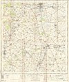
 Foxley Herefordshire SO44 - OS 125,000 Provisional Series Map 1956.jpg 1,654 × 1,050; 1.33 MB
-

-
 Sutton, Herefordshire, OS 1 to 25,000 map of Great Britain, 1950.jpg 1,539 × 898; 1.39 MB
-
 Admiralty Chart No 1826 Burrow Head to Liverpool, Published 1953.jpg 11,149 × 16,186; 58.6 MB
-

-
 Ordnance Survey One-Inch Sheet 134 Huntingdon & Peterborough, Published 1954.jpg 8,262 × 9,932; 9.12 MB
-
 Ordnance Survey One-Inch Sheet 173 East Kent, Published 1959.jpg 8,206 × 9,957; 9.76 MB


