Category:1953 maps of Algeria
Countries of Africa: Algeria
Countries of the Arab world: Algeria
| 1951 1952 1953 1954 1958 1959 |
Media in category "1953 maps of Algeria"
The following 13 files are in this category, out of 13 total.
-
 NH 30-03 - U.S. Army Map Service - 1953 - Colomb Béchar.jpg 5,000 × 3,793; 3.74 MB
-
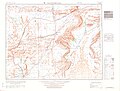
 NI 30-03 - U.S. Army Map Service - 1953 - Melilla.jpg 5,000 × 3,768; 5.13 MB
-
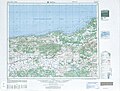
 NI 30-04 - U.S. Army Map Service - 1953 - Oran.jpg 5,000 × 3,788; 5.6 MB
-
 NI 30-07 - U.S. Army Map Service - 1953 - Oujda.jpg 5,000 × 3,778; 5.11 MB
-
 NI 30-08 - U.S. Army Map Service - 1953 - Tlemcen.jpg 5,000 × 3,795; 4.61 MB
-
 NI 30-11 - U.S. Army Map Service - 1953 - Tendrara.jpg 5,000 × 3,806; 3.14 MB
-
 NI 30-12 - U.S. Army Map Service - 1953 - Mécheria.jpg 5,000 × 3,788; 3.41 MB
-
 NI 30-15 - U.S. Army Map Service - 1953 - Bou Arfa.jpg 5,000 × 3,793; 4.14 MB
-
 NI 30-16 - U.S. Army Map Service - 1953 - Figuig.jpg 5,000 × 3,801; 4.74 MB
-
 NI 31-02 - U.S. Army Map Service - 1953 - Borhari.jpg 5,000 × 3,804; 4.5 MB
-
 NI 31-06 - U.S. Army Map Service - 1953 - Aflou.jpg 5,000 × 3,786; 4.47 MB
-
 NI 31-11 - U.S. Army Map Service - 1953 - Ksar el Hirane.jpg 5,000 × 3,769; 4.06 MB
-
 NJ 31-14 - U.S. Army Map Service - 1953 - Blida.jpg 5,000 × 3,798; 4.72 MB


