Category:1960s maps of Russia
Countries of Europe: Albania · Armenia‡ · Austria · Belarus · Belgium · Bulgaria · Cyprus‡ · Denmark · Estonia · Finland · France‡ · Germany · Greece · Hungary · Iceland · Republic of Ireland · Italy · Netherlands‡ · Norway · Poland · Portugal‡ · Romania · Russia‡ · Spain‡ · Sweden · Switzerland · Turkey‡ · Ukraine · United Kingdom
‡: partly located in Europe
‡: partly located in Europe
Countries of Asia: Afghanistan · Armenia‡ · Cambodia · People's Republic of China · Cyprus‡ · Egypt‡ · India · Indonesia‡ · Iran · Iraq · Israel · Japan · Laos · Malaysia · Mongolia · Myanmar · North Korea · Pakistan · Philippines · Russia‡ · Saudi Arabia · Syria · Thailand · Turkey‡ · Turkmenistan · Uzbekistan · Vietnam
Limited recognition: Taiwan · State of Palestine
‡: partly located in Asia
Limited recognition: Taiwan · State of Palestine
‡: partly located in Asia
Subcategories
This category has the following 4 subcategories, out of 4 total.
- 1960 maps of Russia (12 F)
- 1961 maps of Russia (4 F)
- 1962 maps of Russia (2 F)
- 1963 maps of Russia (2 F)
Media in category "1960s maps of Russia"
The following 3 files are in this category, out of 3 total.
-
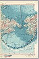 Beringia, 1967.jpg 1,953 × 2,885; 2.19 MB
-
 Korea and Japan, 1967.jpg 2,900 × 4,080; 2.47 MB
-
 Soviet Union 1967 - Eastern Siberia.jpg 4,044 × 2,885; 2.55 MB


