Category:1960s maps of South Africa
Media in category "1960s maps of South Africa"
The following 6 files are in this category, out of 6 total.
-
 1965 Durban area map South Africa by US Army.jpg 4,696 × 4,716; 3.59 MB
-
 1967 data of Central and Southern African countries.jpg 5,856 × 2,900; 2.34 MB
-
 Admiralty Chart Catalogue 1967 Page 047 Index G1.jpg 8,596 × 6,864; 8.55 MB
-
 Admiralty Chart No 1920 Table Bay, Published 1966.jpg 11,238 × 16,397; 42.6 MB
-
 Admiralty Chart No 3861 Anchorages on the South West Coast of Africa, Published 1964.jpg 11,234 × 16,380; 43.49 MB
-
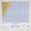
 South Africa, 1967.jpg 2,892 × 2,180; 1.31 MB


