Category:1960s maps of Venezuela
Countries of the Americas: Argentina · The Bahamas · Belize · Brazil · Canada · Chile · Colombia · Costa Rica · Cuba · Guatemala · Haiti · Mexico · Panama · Peru · United States of America · Venezuela
Other areas: Aruba · Greenland · Puerto Rico
Other areas: Aruba · Greenland · Puerto Rico
Media in category "1960s maps of Venezuela"
The following 7 files are in this category, out of 7 total.
-
 1967 data of Northern South America.jpg 1,991 × 2,879; 1.75 MB
-
 Admiralty Chart No 1966 Tortuga to Cabo le Vela, Published 1960.jpg 16,371 × 11,354; 34.5 MB
-
 Admiralty Chart No 493 Approaches to Trinidad, Published 1965.jpg 16,370 × 11,328; 37.18 MB
-
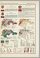
 Ecuador, Colombia, Venezuela and Guiana, 1967.jpg 5,918 × 2,880; 3.61 MB
-
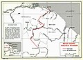 Guyana-Venezuela border.jpg 988 × 713; 159 KB
-
 Venezuela, 1960.jpg 989 × 666; 228 KB
-
 Venezuela, 1967.jpg 5,000 × 4,185; 1.65 MB


