Category:1961 maps of India
Countries of Asia: People's Republic of China · India · Indonesia‡ · Japan · Laos · Russia‡ · Turkmenistan · Vietnam
‡: partly located in Asia
‡: partly located in Asia
| ← 1960 1961 1962 1966 1967 1969 |
English: 1961 maps made in India or from India or showing history of India
Media in category "1961 maps of India"
The following 8 files are in this category, out of 8 total.
-
 Hyderabad District 1951&1961.jpg 1,299 × 1,000; 572 KB
-
 India administrative map 1961 PL.png 1,041 × 1,360; 159 KB
-
 Jangaon Taluk 1961.jpg 1,360 × 962; 383 KB
-
 Jangaon Taluk census 1961.jpg 1,418 × 972; 476 KB
-
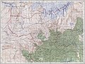
 Map India and Pakistan 1-250,000 Tile NG 46-2 Towang.jpg 5,000 × 3,777; 9.46 MB
-
 Nalgonda District 1961.jpg 965 × 1,326; 378 KB
-
-
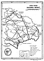
 Warangal District 1961.jpg 1,379 × 1,028; 433 KB


.jpg)
