Category:1962 maps of the Bahamas
Countries of North America: The Bahamas · Canada · Cuba · Guatemala · Haiti · United States of America‡
‡: partly located in North America
‡: partly located in North America
| 1962 |
Media in category "1962 maps of the Bahamas"
The following 2 files are in this category, out of 2 total.
-
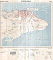 New Providence East 1962 25k topo map G 4982 N4 25 1962- Sheet2.jpg 8,554 × 9,765; 21.06 MB
-
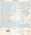 New Providence West 1962 25k topo map G 4982 N4 25 1962- Sheet1.jpg 8,562 × 9,791; 19.7 MB

