Category:1967 maps of North America
Temperate regions: North America · Africa · Europe · Asia · Oceania – Polar regions: – Other regions:
| ← 1960 1961 1962 1963 1964 1965 1966 1967 1968 1969 → |
Subcategories
This category has the following 2 subcategories, out of 2 total.
C
- 1967 maps of Canada (7 F)
U
Media in category "1967 maps of North America"
The following 6 files are in this category, out of 6 total.
-
 Basement map of North America between latitudes 24° and 60° N LOC map67001271.tif 15,679 × 11,900; 533.81 MB
-
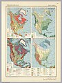 North America 1967 - geology and climate.jpg 2,156 × 2,880; 1.01 MB
-
 North America 1967 - history.jpg 2,164 × 2,884; 960 KB
-
 North America 1967 - human geography.jpg 2,144 × 2,873; 1,022 KB
-
 North America 1967 - land use.jpg 2,152 × 2,866; 1.01 MB
-
 North America 1967 - physical and political.jpg 3,948 × 2,904; 1.98 MB


