Category:1972 maps of the United States
States of the United States: Alabama · California · Florida · Georgia · New Jersey · New York · South Carolina · Texas · Vermont
Subcategories
This category has the following 10 subcategories, out of 10 total.
A
- 1972 maps of Alabama (6 F)
C
- 1972 maps of California (1 F)
F
- 1972 maps of Florida (3 F)
G
N
- 1972 maps of New Jersey (3 F)
S
- 1972 maps of South Carolina (1 F)
T
- 1972 maps of Texas (2 F)
V
- 1972 maps of Vermont (2 F)
Media in category "1972 maps of the United States"
The following 74 files are in this category, out of 74 total.
-
Acadia National Park and vicinity, Hancock Co., Maine. LOC 73690158.jpg 6,640 × 7,066; 9.51 MB
-
Acadia National Park and vicinity, Hancock Co., Maine. LOC 73690158.tif 6,640 × 7,066; 134.23 MB
-
Amistad National Recreation Area, Texas. Aug. 1970. LOC 73695962.jpg 4,920 × 6,800; 4.34 MB
-
Antietam Battlefield. LOC 75692096.jpg 5,784 × 3,358; 3.01 MB
-
Antietam Battlefield. LOC 75692096.tif 5,784 × 3,358; 55.57 MB
-
Appomattox Court House National Historical Park LOC 79690127.jpg 10,558 × 4,619; 4.38 MB
-
Appomattox Court House National Historical Park LOC 79690127.tif 10,558 × 4,619; 139.52 MB
-
Architectural and land use study. LOC 73696017.jpg 5,781 × 7,048; 7.88 MB
-
Architectural and land use study. LOC 73696017.tif 5,781 × 7,048; 116.57 MB
-
Assateague Island National Seashore. LOC 75692111.jpg 11,176 × 3,606; 6.18 MB
-
Assateague Island National Seashore. LOC 75692111.tif 11,176 × 3,606; 115.3 MB
-
Big Bend National Park. Sept. 1955. LOC 73696488.jpg 5,081 × 6,985; 4.86 MB
-
Big Bend National Park. Sept. 1955. LOC 73696488.tif 5,081 × 6,985; 101.54 MB
-
Bike guide, Washington area national parks. LOC 2004625714.jpg 6,834 × 5,227; 6.12 MB
-
Bike guide, Washington area national parks. LOC 2004625714.tif 6,834 × 5,227; 102.2 MB
-
Biscayne National Monument. LOC 73695965.tif 3,964 × 6,795; 77.06 MB
-
Cape Hatteras National Seashore. 1971. LOC 73696489.jpg 4,141 × 5,123; 2.77 MB
-
Cape Hatteras National Seashore. 1971. LOC 73696489.tif 4,141 × 5,123; 60.69 MB
-
Chesapeake and Ohio Canal. LOC 75692108.jpg 11,448 × 7,992; 10.6 MB
-
Chesapeake and Ohio Canal. LOC 75692108.tif 11,448 × 7,992; 261.76 MB
-
Chittenden County, Vermont LOC 81690027.jpg 6,236 × 8,589; 5.94 MB
-
Chittenden County, Vermont LOC 81690027.tif 6,236 × 8,589; 153.24 MB
-
Flooded areas, Medina River, San Antonio, Texas. LOC 77693098.jpg 6,382 × 9,755; 8.16 MB
-
Flooded areas, Medina River, San Antonio, Texas. LOC 77693098.tif 6,382 × 9,755; 178.12 MB
-
Francis Marion National Forest, South Carolina. LOC 75695936.jpg 7,242 × 6,940; 7.33 MB
-
Francis Marion National Forest, South Carolina. LOC 75695936.tif 7,242 × 6,940; 143.79 MB
-
Franklin County, Massachusetts LOC 81690024.jpg 6,549 × 5,546; 5.03 MB
-
Franklin County, Massachusetts LOC 81690024.tif 6,549 × 5,546; 103.91 MB
-
Fredericksburg and Spotsylvania National Military Park. LOC 73695950.jpg 7,594 × 3,388; 4.29 MB
-
Fredericksburg and Spotsylvania National Military Park. LOC 73695950.tif 7,594 × 3,388; 73.61 MB
-
Grand Canyon National Park and vicinity, Arizona LOC 97682276.jpg 17,887 × 11,264; 37.57 MB
-
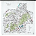
Great Smoky Mountains National Park and vicinity LOC 97681329.jpg 10,738 × 8,598; 24.89 MB
-
Great Smoky Mountains National Park and vicinity LOC 97681329.tif 10,738 × 8,598; 264.15 MB
-
Great Smoky Mountains National Park. 1971. LOC 73691063.jpg 5,898 × 3,423; 3 MB
-
Great Smoky Mountains National Park. 1971. LOC 73691063.tif 5,898 × 3,423; 57.76 MB
-
Guilford Courthouse National Military Park. LOC 73695953.jpg 7,566 × 4,044; 3.39 MB
-
Guilford Courthouse National Military Park. LOC 73695953.tif 7,566 × 4,044; 87.54 MB
-
Hartwell Lake, Georgia and South Carolina. LOC 75690124.jpg 10,534 × 6,806; 7.9 MB
-
Hartwell Lake, Georgia and South Carolina. LOC 75690124.tif 10,534 × 6,806; 205.12 MB
-
Kisatchie National Forest, Louisiana LOC 2011590117.jpg 5,629 × 9,805; 6.06 MB
-
Kisatchie National Forest, Louisiana LOC 2011590117.tif 5,629 × 9,805; 157.91 MB
-
Major land resource areas of Mississippi LOC 92682928.jpg 4,669 × 7,074; 2.93 MB
-
Major land resource areas of Mississippi LOC 92682928.tif 4,669 × 7,074; 94.5 MB
-
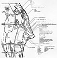
Map of Cape Canaveral launch facilities, 1972.jpg 860 × 872; 148 KB
-
Nantahala National Forest, North Carolina. LOC 75695951.jpg 14,181 × 6,310; 17.38 MB
-
Nantahala National Forest, North Carolina. LOC 75695951.tif 14,181 × 6,310; 256.01 MB
-
New Jersey. LOC 74691925.tif 6,398 × 8,289; 151.73 MB
-
Ozark National Forest (Sylamore Ranger District), Arkansas. LOC 75695914.jpg 5,087 × 5,826; 4.47 MB
-
Ozark National Forest (Sylamore Ranger District), Arkansas. LOC 75695914.tif 5,087 × 5,826; 84.79 MB
-
Redwood National Park. LOC 75696099.jpg 6,015 × 5,125; 4.02 MB
-
Redwood National Park. LOC 75696099.tif 6,015 × 5,125; 88.2 MB
-
Shenandoah National Park LOC 79696653.jpg 11,273 × 6,680; 9.13 MB
-
Shenandoah National Park LOC 79696653.tif 11,273 × 6,680; 215.45 MB
-
States of New Hampshire and Vermont - base map with highways and contours, 1972 LOC 2003620062.tif 6,545 × 8,392; 157.14 MB
-
States of New Hampshire and Vermont - base map, 1972 LOC 2009579180.jpg 6,572 × 8,403; 6.28 MB
-
States of New Hampshire and Vermont - base map, 1972 LOC 2009579180.tif 6,572 × 8,403; 158 MB
-
Stones River National Battlefield, Tennessee. LOC 73695956.jpg 6,124 × 3,549; 3.33 MB
-
Stones River National Battlefield, Tennessee. LOC 73695956.tif 6,124 × 3,549; 62.18 MB
-
Tombigbee National Forest (Tombigbee Ranger District) Mississippi. LOC gm72001970.jpg 5,233 × 7,969; 5.24 MB
-
Tombigbee National Forest (Tombigbee Ranger District) Mississippi. LOC gm72001970.tif 5,233 × 7,969; 119.31 MB
-
Tombigbee National Forest, (Tombigbee Ranger District), Mississippi. LOC 75695929.jpg 8,453 × 7,565; 9.45 MB
-
Tombigbee National Forest, (Tombigbee Ranger District), Mississippi. LOC 75695929.tif 8,453 × 7,565; 182.95 MB
-
W. Kerr Scott Reservoir LOC 78694374.jpg 10,349 × 5,466; 8.05 MB
-
W. Kerr Scott Reservoir LOC 78694374.tif 10,349 × 5,466; 161.84 MB
-
Yellowstone. LOC 73690241.jpg 5,568 × 7,216; 7.18 MB
-
Yellowstone. LOC 73690241.tif 5,568 × 7,216; 114.95 MB


