Category:1980s maps of Canada
Countries of the Americas: The Bahamas · Brazil · Canada · Chile · Colombia · Costa Rica · Cuba · Ecuador · Guatemala · Guyana · Honduras · Mexico · Nicaragua · Panama · Paraguay · Peru · United States of America · Venezuela
Other areas: Aruba · French Guiana · Greenland · Puerto Rico
Other areas: Aruba · French Guiana · Greenland · Puerto Rico
Subcategories
This category has the following 3 subcategories, out of 3 total.
- 1980 maps of Canada (2 F)
- 1985 maps of Canada (5 F)
- 1988 maps of Canada (3 F)
Media in category "1980s maps of Canada"
The following 3 files are in this category, out of 3 total.
-
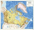 1983-Canada-Topographic-Map.jpg 7,874 × 7,016; 13.31 MB
-
 1987 Edmonton Tornado path.png 678 × 625; 176 KB
-
 Yukon Territorial Election 1989 - Results by Riding.svg 512 × 401; 216 KB


