Category:1981 maps of Maine
States of the United States: Alabama · Arkansas · California · Connecticut · Delaware · Florida · Georgia · Kentucky · Maine · Massachusetts · New York · Ohio · Pennsylvania · South Carolina · Tennessee · Vermont · Virginia
| ← 1980 1981 1986 1987 1988 1989 |
Media in category "1981 maps of Maine"
The following 8 files are in this category, out of 8 total.
-
 Flood hazard study program, Maine LOC 81692942.jpg 2,595 × 6,750; 2.24 MB
-
 Flood hazard study program, Maine LOC 81692942.tif 2,595 × 6,750; 50.11 MB
-
 Maine, Soil Conservation Service administrative map LOC 81693329.jpg 2,545 × 3,299; 1.08 MB
-
 Maine, Soil Conservation Service administrative map LOC 81693329.tif 2,545 × 3,299; 24.02 MB
-
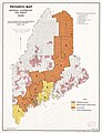 Progress map, national cooperative soil survey, Maine LOC 81693315.jpg 5,044 × 6,583; 4.48 MB
-
 Progress map, national cooperative soil survey, Maine LOC 81693315.tif 5,044 × 6,583; 95 MB
-
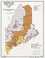 Progress map, national cooperative soil survey, Maine LOC 81693328.jpg 2,541 × 3,297; 1.39 MB
-
 Progress map, national cooperative soil survey, Maine LOC 81693328.tif 2,541 × 3,297; 23.97 MB


