Category:1987 maps of Texas
States of the United States: California · Connecticut · Maine · Massachusetts · Ohio · Pennsylvania · South Carolina · Texas
| ← 1980 1982 1986 1987 1989 → |
Media in category "1987 maps of Texas"
The following 17 files are in this category, out of 17 total.
-
 Administrative map, Texas, area 2 LOC 92684522.jpg 8,967 × 6,244; 3.62 MB
-
 Administrative map, Texas, area 2 LOC 92684522.tif 8,967 × 6,244; 160.19 MB
-
 Big Bend National Park, Texas LOC 87693955.tif 10,065 × 7,131; 205.35 MB
-
 Highly erodible cropland - (in Texas) LOC 88691859.tif 8,982 × 5,941; 152.67 MB
-

-

-

-
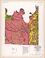
 Interpretative map of agricultural land distribution. Mitchell County, Texas LOC 88691583.jpg 10,068 × 7,808; 7.62 MB
-
 Interpretative map of agricultural land distribution. Mitchell County, Texas LOC 88691583.tif 10,068 × 7,808; 224.91 MB
-

-
 Interpretative map of agricultural land distribution. Parmer County, Texas LOC 88691586.tif 8,504 × 6,963; 169.41 MB
-
 Interpretative map of agricultural land distribution. Roberts County, Texas LOC 88691587.tif 9,263 × 6,981; 185.01 MB
-
 Interpretative map of urbanization potential. Collin County, Texas LOC 88691577.tif 9,120 × 6,702; 174.87 MB
-
 Interpretative map of urbanization potential. Cooke County, Texas LOC 88691578.jpg 7,950 × 10,206; 10.83 MB
-
 Interpretative map of urbanization potential. Cooke County, Texas LOC 88691578.tif 7,950 × 10,206; 232.14 MB
-
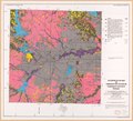
 Interpretative map of urbanization potential. Tarrant County, Texas LOC 88691580.jpg 8,254 × 7,456; 8.5 MB
-
 Interpretative map of urbanization potential. Tarrant County, Texas LOC 88691580.tif 8,254 × 7,456; 176.07 MB


