Category:19th-century maps of Cambridge, Massachusetts
Subcategories
This category has the following 16 subcategories, out of 16 total.
1
Media in category "19th-century maps of Cambridge, Massachusetts"
The following 34 files are in this category, out of 34 total.
-

-
-

-
 1831 MtAuburnCemetery BPL3370528616.jpg 1,549 × 2,000; 2.84 MB
-

-

-

-
 1852 Middlesex Canal (Massachusetts) map.jpg 2,310 × 3,365; 9.03 MB
-

-

-

-
-

-
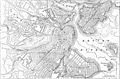 EB9 Boston.jpg 2,559 × 1,681; 961 KB
-

-

-
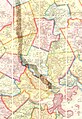
 Henry Bond map of Watertown Massachusetts.gif 4,460 × 2,863; 438 KB
-

-

-

-
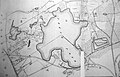
 Map of Fresh Pond (Cambridge, Mass.), 1841.tif 8,507 × 6,705; 163.21 MB
-
 Map of Fresh Pond, 1841.jpg 2,000 × 1,697; 2.77 MB
-
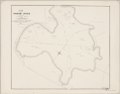
 Map of part of Cambridge, Mass (3369705617).jpg 2,843 × 2,351; 1.3 MB
-
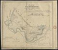
 Mount Auburn, avenues and paths (3370528466).jpg 1,795 × 2,000; 3.63 MB
-
 Olmsted Fresh Pond Park map 1897.agr.jpg 4,032 × 3,024; 5.64 MB
-
 Plan for proposed Charles River Park (3719855443).jpg 1,024 × 630; 467 KB
-
 Plan of a part of Cambridge showing the location of the Fayerweather Estate (3855696875).jpg 2,000 × 1,554; 2.38 MB
-
-

-

-
 Plan of property in the Cambridgeport marshes (3370526274).jpg 2,000 × 1,395; 2.31 MB
-
 Plan of the cemetery of Mount Auburn (3720668892).jpg 1,024 × 848; 754 KB
-
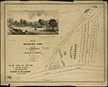
 Sights in Boston and suburbs, or, Guide to the stranger (1856) (14758885624).jpg 1,962 × 2,036; 456 KB
-

_Map_of_Cambridge_roads,_by_Peter_Tufts,_Jr.,_from_the_Digital_Commonwealth_-_commonwealth_wd378h641.jpg)


_map.jpg)


,_1879_-_reprinted_in_Fresh_Pond,_The_History_of_a_Cambridge_Landscape,_by_Jill_Sinclair,_2009_-_Fresh_Pond,_MA_-_DSC02593.jpg)
.jpg)


,_by_John_G._Hales,_1819_-_reprinted_in_Fresh_Pond,_The_History_of_a_Cambridge_Landscape,_by_Jill_Sinclair,_2009_-_Fresh_Pond,_MA_-_DSC02583.jpg)
,_by_John_G._Hales,_1819_-_reprinted_in_Fresh_Pond,_The_History_of_a_Cambridge_Landscape,_by_Jill_Sinclair,_2009_-_Fresh_Pond,_MA_-_DSC02588.jpg)
_by_John_Hales,_1830_-_reprinted_in_Fresh_Pond,_The_History_of_a_Cambridge_Landscape,_by_Jill_Sinclair,_2009_-_Fresh_Pond,_MA_-_DSC02574.jpg)

.jpg)
.jpg)

.jpg)
.jpg)
.jpg)
.jpg)
.jpg)
.jpg)
.jpg)
_(14758885624).jpg)
_(14784417342).jpg)