Category:19th-century maps of Denver, Colorado
Subcategories
This category has the following 4 subcategories, out of 4 total.
1
- 1870s maps of Denver, Colorado (13 F)
Media in category "19th-century maps of Denver, Colorado"
The following 3 files are in this category, out of 3 total.
-
 Map of Denver City - DPLA - 4c0ae501fd11e60742a01ad605abf50e.jpg 5,792 × 9,000; 5.56 MB
-
 Map of Denver City - DPLA - c3b7f936d07e52c0f227e531cb94753b.jpg 8,199 × 9,000; 6.43 MB
-
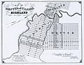 Map of Denver, Auraria and Highland - DPLA - 91770498d8629224914ebfe61fc481ef.jpg 8,999 × 7,050; 13.69 MB


