Category:19th-century maps of Gibraltar
Countries of Europe: Albania · Armenia‡ · Austria · Azerbaijan‡ · Belarus · Belgium · Bosnia and Herzegovina · Bulgaria · Croatia · Cyprus‡ · Czech Republic · Denmark · Estonia · Finland · France‡ · Georgia‡ · Germany · Greece · Hungary · Iceland · Republic of Ireland · Italy · Latvia · Lithuania · Luxembourg · Malta · Moldova · Montenegro · Netherlands‡ · North Macedonia · Norway · Poland · Portugal‡ · Romania · Russia‡ · Serbia · Slovakia · Slovenia · Spain‡ · Sweden · Switzerland · Turkey‡ · Ukraine · United Kingdom
Specific status: Gibraltar · Isle of Man – Limited recognition: Abkhazia‡
‡: partly located in Europe
Specific status: Gibraltar · Isle of Man – Limited recognition: Abkhazia‡
‡: partly located in Europe
Media in category "19th-century maps of Gibraltar"
The following 34 files are in this category, out of 34 total.
-
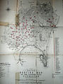 1800s Calpe Hunt Map.jpg 478 × 640; 93 KB
-
 1810 Gibraltar Northern Defences map.jpg 1,803 × 1,287; 1.05 MB
-
 1831 - Gibraltar W.H. Smyth Moorish Tower detail.jpg 640 × 434; 101 KB
-
 1851 Tallis map of British Possessions in the Mediterranean (engraved by John Rapkin).jpg 1,587 × 2,187; 1.63 MB
-
 1859 Gibraltar fortifications map.jpg 5,764 × 2,098; 4.91 MB
-
 018 Map of Gibraltar.jpg 1,463 × 2,149; 1.31 MB
-
 Plan of Gibraltar.jpg 3,003 × 1,923; 2.45 MB
-

-

-

-
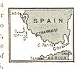
 Kärtchen des vorgebirges von gibraltar.jpg 369 × 544; 124 KB
-

-

-
 1893 Gib map hm field.jpg 2,044 × 2,953; 479 KB
-

-
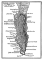
 O'SHEAS (1895) p286 GIBRALTAR.jpg 634 × 1,320; 483 KB
-

-
 467 of 'Historia de Gibraltar y de su campo, etc' (11059094153).jpg 1,655 × 3,430; 1.13 MB
-
-

-
-
 Actes de la Société linnéenne de Bordeaux BHL16211260.jpg 2,368 × 2,683; 748 KB
-
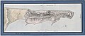
 Admiralty Chart No 144 Gibraltar, Published 1886.jpg 6,040 × 8,182; 5.21 MB
-
 Gibraltar barcelo 1849.png 2,110 × 2,472; 9.29 MB
-
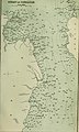
 Gibraltar Map 1835.png 421 × 749; 380 KB
-
 Hardy Town 1811 map.jpg 709 × 592; 257 KB
-
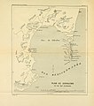
 Inundation Gibraltar 1811 map.jpg 769 × 719; 280 KB
-

-

-
 Map of Gibraltar Bay (1803).png 2,510 × 3,471; 7.23 MB
-
 Meyers b7 s0326 b1.png 393 × 542; 75 KB
-
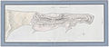
 Plan de Gibraltar A H Roché.jpg 9,109 × 3,912; 12.21 MB
-
 Plan de Gibraltar faded.jpg 800 × 344; 63 KB
-
 Sortie of the Garrison of Gibraltar.jpg 7,848 × 5,728; 10.4 MB


.jpg)


_(14583189127).jpg)
_(14766486411).jpg)
_(14769325852).jpg)

.jpg)
.jpg)

%27_(11134037064).jpg)
_p286_GIBRALTAR.jpg)
.jpg)
.jpg)
.jpg)
%27_(11260223744).jpg)
_(14595238117).jpg)


_(14760895671).jpg)

.png)


