Category:19th-century maps of Grenoble
Subcategories
This category has the following 2 subcategories, out of 2 total.
Media in category "19th-century maps of Grenoble"
The following 45 files are in this category, out of 45 total.
-
 1 Avant le chemin de fer.tif 3,004 × 4,100; 11.77 MB
-
 Avant le chemin de fer.jpg 3,004 × 4,100; 2.04 MB
-
 Blvd Gambetta 1815-1887 Grenoble.png 1,102 × 357; 653 KB
-
 Carte des environs de Grenoble - btv1b530880153.jpg 4,480 × 3,344; 1.57 MB
-
 Detail Plan Grenoble 1813.png 980 × 625; 442 KB
-

-
-
 Extrait plan Grenoble 1878.JPG 1,672 × 1,284; 527 KB
-
 Grenoble 1864.jpg 4,226 × 3,124; 4.5 MB
-
 Grenoble 1882.jpg 4,276 × 3,096; 2.37 MB
-
 Grenoble avant 1830.jpg 3,156 × 4,303; 2.85 MB
-
 Nouveau Plan de Grenoble - dessiné par François Meunier - btv1b8440720b.jpg 10,762 × 8,639; 12.17 MB
-
 Nouveau Plan de Grenoble - dessiné par François Meunier - btv1b8440771n.jpg 10,890 × 8,697; 11.64 MB
-
 Nouveau Plan de Grenoble - dessiné par François Meunier - btv1b8440773g.jpg 8,862 × 5,878; 6.15 MB
-

-
 Nouveau Plan de la ville de Grenoble - par Eléogard Marchand, 1884 - btv1b8439262g.jpg 8,556 × 6,476; 7.93 MB
-
 Plan 2e étage musée-bibliothèque de Grenoble (1837).jpg 1,200 × 657; 176 KB
-
 Plan 2° ét. Lycee Stendhal - Grenoble.jpg 1,024 × 749; 142 KB
-

-
 Plan d'une partie du Mont-Rachet près de Grenoble - Anger - btv1b10663754q.jpg 2,197 × 2,953; 1.06 MB
-
 Plan de Grenoble - btv1b8439853k.jpg 10,674 × 8,838; 14.03 MB
-
 Plan de Grenoble - btv1b8441378g.jpg 10,617 × 8,627; 15.16 MB
-
 Plan de Grenoble - btv1b8442032r.jpg 10,246 × 8,112; 14.65 MB
-
 Plan de Grenoble - Eléogard Marchand - btv1b106635774.jpg 3,336 × 2,684; 832 KB
-
 Plan de Grenoble - Eléogard Marchand - btv1b10663585n.jpg 2,908 × 2,258; 940 KB
-
 Plan de Grenoble - lith. C. Pegeron - btv1b530876045.jpg 8,408 × 6,504; 8.72 MB
-
 Plan de Grenoble 1869.jpg 855 × 539; 199 KB
-
 Plan de Grenoble 1885 - Eléogard Marchand, del. - btv1b55011130z.jpg 4,418 × 3,449; 2.24 MB
-
 Plan de Grenoble en 1875 - Delaye, B. - btv1b10663574s.jpg 3,900 × 3,003; 1.52 MB
-
 Plan de Grenoble par circonscriptions médicales - btv1b106635791.jpg 1,979 × 2,933; 408 KB
-
 Plan de Grenoble... 1-8 000 - par F. Seytoux..., 1er décembre 1892 - btv1b8440528z.jpg 8,015 × 6,277; 6.37 MB
-
-

-
-
 Plan de la ville de Grenoble en 1868 - Génard - btv1b10663573b.jpg 4,255 × 5,179; 3.21 MB
-
 Plan du quartier.JPG 2,304 × 1,712; 1.38 MB
-

-
 Plan, n°1 - btv1b106635757.jpg 3,029 × 2,463; 1,006 KB
-
 Polygone scientifique-Grenoble-1894.png 1,011 × 673; 1.2 MB
-

-

-
 Projet nouvelle mairie Grenoble 1857.JPG 2,512 × 2,217; 1.17 MB
-
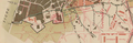
 Terrains annexés par Grenoble en 1862.JPG 3,591 × 2,671; 2.23 MB
-

-
 Ville de Grenoble. Ouverture de voies centrales - btv1b10663583r.jpg 7,301 × 5,799; 4.97 MB


_-_(Sign%C3%A9)_Barrillon_-_btv1b530849834.jpg)

.jpg)

._Echelle_de_0,_002_pour_2_m%C3%A8tres._(1_-_500_Sign%C3%A9_-_)._le_S._lieutenant_de_la_7%C2%B0_Compe._d%27ouvriers,_Faney_-_btv1b53233219x.jpg)


_de_rues_et_des_projets_d%27agrandissement_-_dress%C3%A9_J.M._Vagnat,_architecte_-_btv1b530353129.jpg)


