Category:19th-century maps of Hawaii
States of the United States: Alabama · Alaska · Arizona · Arkansas · California · Colorado · Connecticut · Delaware · Florida · Georgia · Hawaii · Idaho · Illinois · Indiana · Iowa · Kansas · Kentucky · Louisiana · Maine · Maryland · Massachusetts · Michigan · Minnesota · Mississippi · Missouri · Montana · Nebraska · Nevada · New Hampshire · New Jersey · New Mexico · New York · North Carolina · North Dakota · Ohio · Oklahoma · Oregon · Pennsylvania · Rhode Island · South Carolina · South Dakota · Tennessee · Texas · Utah · Vermont · Virginia · Washington · West Virginia · Wisconsin · Wyoming – Washington, D.C.
Puerto Rico
Puerto Rico
Subcategories
This category has the following 6 subcategories, out of 6 total.
- 1820s maps of Hawaii (3 F)
- 1830s maps of Hawaii (10 F)
- 1840s maps of Hawaii (5 F)
- 1880s maps of Hawaii (13 F)
- 1890s maps of Hawaii (22 F)
Media in category "19th-century maps of Hawaii"
The following 7 files are in this category, out of 7 total.
-

-
-
 1804-Russian-map-Hawaii.jpg 2,802 × 2,002; 1.89 MB
-
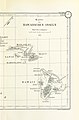
 PERKINS(1854) p104 Map of the Hawaiian or Sandwich Islands.jpg 1,925 × 1,285; 1.07 MB
-
 1855 Colton Map of Hawaii and New Zealand - Geographicus - Hawaii-colton-1855.jpg 2,863 × 3,500; 2.63 MB
-

-

%27_(11227531444).jpg)
%27_(11229185015).jpg)

_p104_Map_of_the_Hawaiian_or_Sandwich_Islands.jpg)

.jpg)
.jpg)