Category:19th-century maps of Malaysia
Media in category "19th-century maps of Malaysia"
The following 9 files are in this category, out of 9 total.
-

-
 UB Utrecht - Ackersdijck 173 (Dk26-11) - 1842 03.jpg 5,331 × 7,166; 19.27 MB
-

-

-

-
-

-
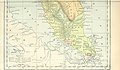
 MapBorneo.jpg 286 × 170; 28 KB
-

.jpg)
_-_1842_03.jpg)
.jpg)

%27_(16564151426).jpg)
.jpg)


%27_(11194908213).jpg)